Pavement Inspection with Drones: Standards, Precision, and Global Applications
Global Standards for Pavement Inspection
Traditional pavement inspections rely on standardized rating systems to evaluate surface conditions. The most widely used is the Pavement Condition Index (PCI) – a numerical rating from 0 (failed) to 100 (excellent) based on types and severity of distresses. Originally developed by the U.S. Army Corps of Engineers and standardized by ASTM (e.g. ASTM D5340 for airports and D6433 for roads), PCI is used extensively in the US and has been adopted or adapted in many regions. For example, France’s VIZIR method (Visuel d’Itinéraires à Risque) similarly quantifies road distresses by type and severity, and was even adapted by the Colombian Department of Transportation (INV E-813-13) as a local standard. In essence, these methods provide objective metrics for pavement condition and maintenance planning.
In the United States, federally funded airports are expected to implement a Pavement Maintenance Program that includes regular inspections. FAA guidance recommends annual detailed inspections of airfield pavement, but if the airport maintains a history of PCI surveys, the interval for detailed surveys can extend to three years. In practice, many larger US airports conduct PCI surveys every 3 years (often to support funding requests and maintenance plans), while smaller airports or those without formal PCI requirements still perform routine visual inspections to ensure safety. Even if an official PCI score isn’t mandated, those airports can benefit from simplified drone-based surveys to validate surface condition and catch emerging issues early. Internationally, similar practices exist – for instance, many road authorities require periodic condition assessments (whether PCI or an equivalent index) to guide rehabilitation. The common thread is that consistent standards (like PCI) allow drone-collected data to be translated into familiar ratings, making drone inspections compatible with existing pavement management systems worldwide.
Precision Requirements and Camera Resolution
A key advantage of drones is the ability to capture high-resolution imagery needed to identify small pavement distresses (cracks, raveling, potholes, etc.). Precision is critical: hairline cracks only a few millimeters wide demand a ground sample distance (GSD) on the order of 1–3 mm/pixel to be reliably detected in images. Achieving such GSD typically requires low-altitude flights or high-end sensors. Research and field trials have quantified this trade-off: for example, flying at ~5 m altitude can yield ~0.2 cm/pixel (2 mm) resolution, whereas flying at 60 m might yield ~1.5 cm/pixel (15 mm). In one study, a DJI drone at 3–5 m altitude achieved about 0.11–0.18 cm/pixel (1.1–1.8 mm) GSD – sufficient to clearly visualize fine cracks. Higher altitudes quickly reduce detail: imagery collected from 10–15 m typically has ~1 cm precision in measuring defects, and beyond ~30 m altitude the error can exceed 1.5 cm.
Recommended resolutions have emerged from these studies. An FAA research program across multiple airports concluded that orthophotos of ~1.5 mm/pixel are “highly recommended” for reliable airfield crack detection, with digital surface models of ~6 mm/pixel for assessing pavement profiles. In practice, this means using high-resolution cameras (20 MP or greater) and flying relatively low altitudes in a grid to cover the pavement. For instance, a 20 MP camera with a 1″ sensor might need to fly ~8–10 m above ground to get ~2 mm GSD. In field use, drone operators often balance coverage and detail by flying in sections: e.g. splitting a long runway into many small flight blocks to keep altitude low while eventually covering the whole area. Modern photogrammetry software can stitch hundreds or thousands of overlapping images into a single geo-referenced orthomosaic that preserves millimeter-level detail of cracks and surface texture.
Camera needs: True color RGB cameras suffice for standard surface distress surveys. Most projects use off-the-shelf drone cameras (like DJI’s high-res sensors) to capture orthogonal (nadir) shots because vertical images produce the most accurate measurements. The imagery must be clear enough to distinguish fine cracks from pavement texture and should be well-lit (flights are usually done in good daylight and clear weather for best results). Some efforts also explore multi-sensor approaches: for example, thermal cameras can highlight subsurface moisture or delamination zones (since those areas heat/cool differently) and LiDAR scanners can directly measure rut depths or surface roughness. While RGB imagery with AI analysis is the primary method for crack and pothole detection, these additional sensors can complement an inspection – e.g. thermal imaging might detect early-stage damage beneath asphalt, and LiDAR can quantify unevenness that visual methods might miss. In short, a combination of sensors can provide a more comprehensive pavement health profile, though at added cost and complexity. For most routine inspections, a high-resolution RGB camera on a stable drone platform is the workhorse.
Drone Inspection of Airport Runways
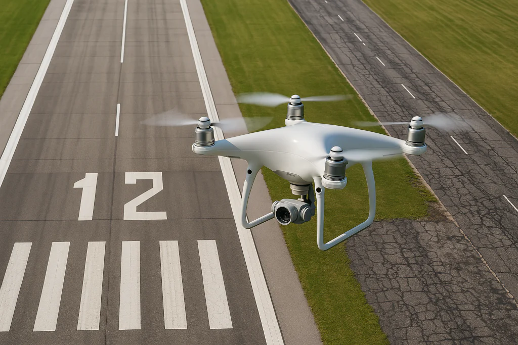
Airport runways are a prime application for drone inspections. They are wide, long structures where early detection of cracks or Foreign Object Debris (FOD) is critical for safety. Traditionally, inspections involve closing the runway and sending personnel or slow-moving vehicles to visually scan the surface – a laborious process that can take hours for a large runway. Drones offer a faster, detailed alternative. Case studies at major airports have demonstrated significant benefits:
Paris Charles de Gaulle (CDG) Airport: In 2016, ADP (Paris Airports Authority) conducted a large-scale drone pavement inspection on a CDG runway – one of the first in the world. A surface area of over 200,000 m² (roughly 30 soccer fields) was captured in about 1 hour 45 minutes of net flight time, divided into nine short segments to minimize disruption. Each flight segment lasted ~18 minutes and was carefully timed during gaps in air traffic, with full coordination with air traffic control and safety checks (including FOD sweep) between flights. The drone collected an ultra-high-resolution orthomosaic of the runway. According to project reports, the imagery resolution was extreme – on the order of a few millimeters per pixel – allowing detailed mapping of every crack and distress on the runway. The analysis was documented in an interactive map and report, accounting for ICAO and EASA standards on permissible distress limits. As a result, airport engineers could pinpoint areas for repair, schedule targeted maintenance, and ultimately extend the pavement’s lifespan while reducing cost and enhancing safety for aircraft operations. Notably, this drone-based survey augmented (not fully replaced) the conventional inspections – it was used in conjunction with on-ground verification – but it proved the concept that regular runway surveys could be done faster and with greater detail than human teams alone. French and German airports, in fact, have since incorporated such drone surveys alongside routine visual inspections.
London Heathrow Airport: Heathrow has tested drones primarily to scan for FOD and inspect runway surface condition between flight operations. Initial trials showed drones can sweep a runway in a fraction of the time of a manual inspection. Equipped with AI object detection, they not only map cracks but also identify debris. This is particularly useful at busy hubs – reducing runway downtime needed for inspections. (Heathrow’s trials were reported as part of efforts to enhance safety; it’s an example of a major international airport validating the technology.)
North American Airports: In the U.S. and Canada, several demonstrations have taken place at small and medium airports. The FAA’s Airport Technology R&D group conducted multi-airport trials in 2020–2022: tests at five airports (such as Habersham County, GA and Roosevelt, NJ) developed procedures for integrating drones into an airport’s Pavement Management Program. They identified which distress types are detectable via drones and established data collection workflows. A total of 97 missions were flown across varied conditions, amassing ~1.5 TB of imagery data for analysis (indicating the level of detail captured). The final FAA report confirms that all the distresses noted in traditional “foot-on-ground” surveys could be identified in drone imagery when the GSD was ~2 mm/pixe. In other words, a drone survey with 2 mm resolution was effectively equivalent to a human visual PCI inspection in terms of findings – but faster and more consistent. Some smaller airports (e.g. Red Deer Regional Airport in Canada) have partnered with drone service companies to perform routine runway inspections, aiming to increase safety while cutting inspection time. In remote regions of Canada, where over 100 airports have gravel runways that are hard to reach, researchers demonstrated that drones plus AI can inspect a runway without flying an engineer on-site. This method, tested on gravel airstrips in Northern Canada, automatically detects defects like potholes, washouts, vegetation encroachment, etc., and is expanding to other remote areas (Australia, New Zealand) where traditional inspections are costly. Even though gravel runways differ from asphalt, this showcases drones’ versatility in runway maintenance.
In all these cases, a common consideration is regulatory clearance and operational safety. Drones at airports must be operated with stringent precautions: typically only during closed-runway periods or under ATC oversight, and often within visual line of sight of the pilot for control and legal compliance. Many aviation authorities (FAA, EASA, etc.) restrict drone flights near active runways, so these inspections are usually done during scheduled maintenance closures or low-traffic periods. Despite these coordination challenges, the payoff is significant – an entire runway can be inspected in high detail during a short closure window. For busy airports, that means less impact on flight operations; for remote or military airstrips, it means inspections can be done without waiting for specialized crews. Overall, drone runway inspections are proving faster, richly detailed, and potentially safer (by keeping personnel off active runways) compared to legacy methods
Drone Inspection of Roads and Highways
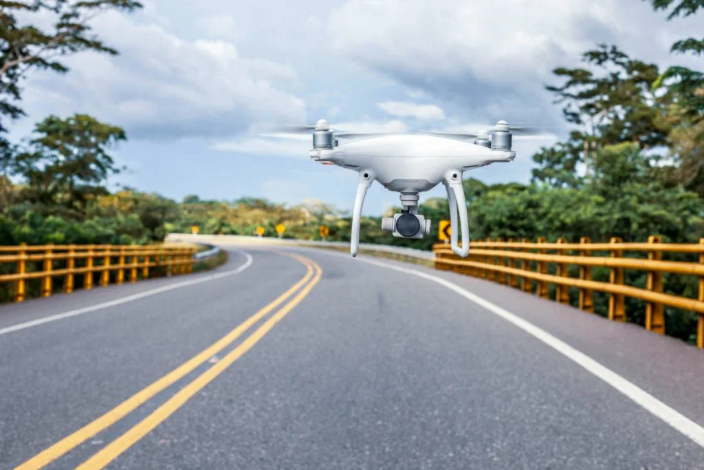
Beyond airfields, drones are increasingly used for roadway and highway pavement inspections. Highway agencies and municipalities worldwide face the task of surveying long stretches of asphalt for cracks, potholes, and pavement health – tasks drones can accelerate dramatically. A standout example comes from the Middle East:
Kuwait’s Nationwide Road Survey: In 2024, Kuwait’s Ministry of Public Works partnered with a drone services provider (Zain Drone) to inspect the country’s major roads. In the first phase, 1,000 km of highways and bridges were surveyed by drone, capturing high-resolution imagery and video of the pavement This massive project produced a detailed map of road conditions, and a second phase will extend to the secondary road network. The benefits cited were substantial – no traffic closures were needed (drones can fly over or alongside traffic at safe altitudes), and the drones produced precise maps and 3D models of the roads far faster than conventional crews. According to officials, using drones improved safety and accuracy, reduced the time and effort of inspection, and provided data that is both richer and more objective (automated scanning reduces human error in noting defects). It also cut costs by minimizing labor and enabling proactive maintenance tenders based on the collected data. This Middle Eastern project illustrates that hundreds of kilometers can be inspected via drones in a single initiative, something that would have been logistically daunting with manual surveys.
Other Notable Projects: In Saudi Arabia, the General Authority for Roads announced in 2023 the use of drones for regular highway inspection tours to enhance efficiency. The initiative highlighted time savings (covering long distances quickly) and even uses thermal imaging to detect hidden pavement deformations. In South America, researchers and city authorities have tested drones in countries like Brazil, Colombia, and Chile to monitor road conditions in urban and rural areas. For instance, one study in Colombia applied both PCI and VIZIR methodologies on urban roads using drone imagery, finding that the drone-based ratings closely matched traditional visual survey results. The advantage was speed – the UAS could capture an entire road section’s distresses in detail, whereas a visual crew might sample or take longer. In Australia and New Zealand, which have extensive road networks and mining haul roads in remote areas, interest in drone inspections is growing (similar to the Canadian remote runway case) to reduce the need for sending crews long distances for pavement assessment. Even in Europe, early adopters exist: several EU research projects and city pilots (in Spain, Portugal, etc.) have used drones to map road crack density and potholes on municipal streets.
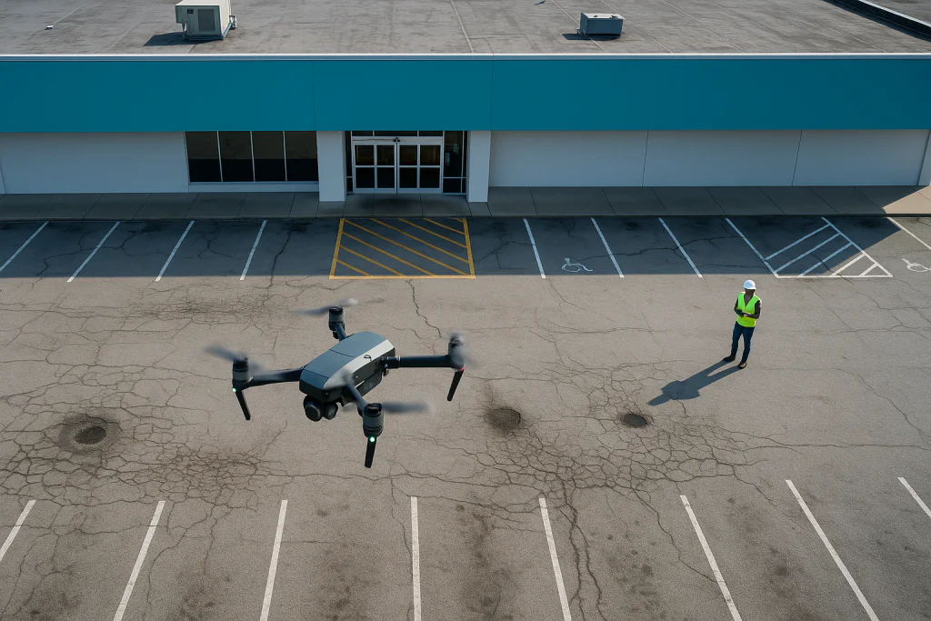
The scale of road inspections can vary from small parking lots to thousands of kilometers of highway. Drones are scalable to both extremes. For a parking lot or urban street network, a multirotor drone can map the area in minutes and create an orthomosaic identifying each crack – useful for facility managers or city public works. For highways, fixed-wing or VTOL drones can be advantageous since they cover longer linear distances per flight. For example, a fixed-wing drone flying at higher altitude might not capture fine cracks but can quickly scan for major distresses (like large potholes or excessive cracking) over tens of kilometers. Then, multirotor drones can be deployed to hot spots for closer inspection if needed. In all cases, the data from drone surveys can feed into pavement management systems. If PCI is used, the drone-detected distresses (crack length, area of patching, rut depth, etc.) can be quantified to calculate a PCI score for road segments. Automated algorithms are already capable of classifying cracks (longitudinal, transverse, alligator cracking, etc.) and measuring their extent from imagery. This means a drone can not only take pictures, but with AI, it can “understand” the distresses and output a condition rating. Several studies report machine learning models (CNNs, SVMs, random forests, etc.) achieving over 95–98% accuracy in detecting pavement damage on drone-captured images. Such AI-driven analysis greatly reduces the manual effort of reviewing imagery.
Real-world outcomes: Where implemented, drone road inspections have shown clear advantages. Municipalities avoid weeks of road-closure and labor for manual surveys, and instead gather data in days. For example, a U.S. city (Harrisonburg, VA, in one case study) found that a drone could inspect 220 miles (~350 km) of its roads for potholes faster than a crew driving every street. In the Middle East, as noted, 1000+ km were evaluated in a project that likely took only a few months in total – an unprecedented pace. This speed and area-coverage benefit opens the door to more frequent pavement assessments. Rather than an annual or multi-year cycle, authorities can fly drones after each winter season, for instance, to quickly identify new frost-crack damage and schedule repairs before they worsen. More frequent data can lead to more proactive maintenance, ultimately saving costs by fixing issues early (aligning with the philosophy that “$1 of prevention saves $5 in future repairs” in pavement management).
Benefits Over Traditional Methods
Integrating drones into pavement inspections offers a host of benefits compared to traditional methods (foot patrols or vehicle-mounted surveys). Key advantages include:
Speed and Coverage: Drones can scan large areas quickly, drastically reducing data collection time. A runway that might require a 2-hour closure for a manual walkdown can be imaged in 20–30 minutes by drone. Highways that would take days of slow driving surveys can be flown in a fraction of the time. This also means minimal downtime or lane closures on operational infrastructure – for example, many drone road surveys can be done under light traffic without closing lanes, or at night, causing less disruption.
Worker Safety and Liability: By removing inspectors from dangerous environments (busy runways, roadsides, or high-traffic highways), drones improve safety. Inspectors no longer need to be physically on the pavement with moving traffic or live airport operations, which lowers the risk of accidents. It also reduces liability and the need for extensive safety measures (work zone setups, etc.). Drones are especially valuable for accessing hard-to-reach or hazardous areas – for instance, they can safely inspect highway bridges, steep embankments, or active airfields where putting a person would be risky.
Cost-Effectiveness: While drones have an upfront cost, they are relatively affordable to operate compared to deploying crews and survey vehicles, particularly over large areas. Multiple studies have noted cost savings in both labor and equipment when using small UAS for pavement surveys. Additionally, better data leads to more optimized maintenance – by fixing the right areas, agencies avoid overspending on premature overlays or, conversely, costly reconstructions from missed distress. The Kuwait project press release explicitly mentions reduced operational costs due to using drone data for more efficient road maintenance planning.
Data Quality and Detail: Drones provide high-definition, permanent records of pavement condition. Instead of an inspector’s handwritten notes or subjective ratings, you get an orthophoto where every crack is mapped. This leads to more objective assessments and the ability to re-analyze data later (or apply new AI algorithms) without another field visit. High overlap imagery and low-angle lighting can even reveal subtle surface issues that an on-ground inspector might overlook. In side-by-side comparisons, UAS imagery has captured greater quantities of certain distresses – for example, one trial found the drone-based survey measured 42% more “crocodile” cracking area on a section than the field crew had recorded, highlighting how high-res images pick up fine fissures that humans might miss. Likewise, UAS detected slightly more shrinkage cracks and quantified patch areas more precisely in comparative studies. Overall, drones give a “magnifying glass” view of the pavement, resulting in a very comprehensive distress inventory.
Advanced Analysis (AI and 3D): The digital nature of drone data means it can feed directly into software. Algorithms can automatically classify cracks, calculate their lengths/widths, count potholes, and even compute a PCI or other index from the imagery. This promises faster processing of results – what used to take weeks of manual data entry can be done in hours. Moreover, 3D models from drones (using photogrammetry or LiDAR) can assess not just surface flaws but also surface evenness and rutting. A drone-derived DEM (digital elevation model) at 5–6 mm precision can reveal depressions or ruts in the wheel paths of a runway or road. Such geometric data is difficult to capture by visual inspection alone. Having orthophotos and 3D surface maps also aids future monitoring: changes can be detected by overlaying data from year to year.
Environmental and Logistical Benefits: Drone inspections are relatively quiet and clean – they produce less noise and no road damage (contrast with heavy survey vehicles) and lower carbon footprint than sending crews driving for days. Especially for remote or sprawling networks, cutting down travel through drone use is a “greener” approach. Logistically, drones are quite flexible – a team can mobilize a small drone unit quickly to wherever needed, without the need for large equipment convoys.
While the benefits are compelling, there are also practical considerations and limitations to acknowledge:
Weather and Lighting: Drones generally cannot operate in heavy rain, strong winds, or other adverse weather. Pavement inspections ideally need dry conditions (a wet surface obscures cracks) and good lighting. This can constrain scheduling. High temperatures can also affect drone battery performance and sensor accuracy (though thermal imaging might be done at night when the pavement cools).
Battery Life and Flight Time: Most small drones have limited flight times (20–30 minutes per battery). Covering a very large area may require multiple battery swaps or multiple drones operating in tandem. This was seen in the CDG example – splitting into 9 flights due to battery and operational limits. However, as drone tech improves, newer models and the use of battery swap stations or tethered drones might extend operational time.
Traffic Management: For road inspections, managing traffic can still be an issue. Drones flying low over a highway might be distracting to drivers, so typically agencies schedule drone flights during off-peak hours or brief lane closures if flying very low. The advantage is drones can often stay above the traffic or on the shoulder, but caution is required (some jurisdictions have rules about not flying directly over active traffic for safety). In the FAA studies, they note any drone inspection must avoid causing FOD or hazards – hence why runway drone ops include post-flight FOD checks. In essence, the infrastructure may need to be partially closed for a truly thorough survey (especially at the lowest altitudes), but the closure is much shorter than a manual one.
Regulatory Restrictions: Different countries have different drone regulations. In many places, flying Beyond Visual Line of Sight (BVLOS) – which would be useful for long highway stretches – requires special permission. Similarly, airports need waivers to fly drones in controlled airspace. Regulations are gradually adapting, but compliance adds complexity. Often an experienced, licensed drone operator is needed to navigate these rules. That said, regulators are recognizing infrastructure inspection as a valid drone use case and have been granting waivers (e.g. FAA waivers for airport drone use under specific safety cases, or Canadian regulators allowing drone use at remote airports as in the Northeastern University project).
Data Processing and Storage: Collecting high-resolution data means dealing with large datasets. After a drone flight, processing hundreds of images into an orthomosaic can take hours on powerful computers. For instance, one airport project generated 1.5 TB of raw data that had to be processed. Agencies need the IT infrastructure to handle this (though cloud processing and improved photogrammetry software are making this easier). There’s also a need for training staff to interpret drone outputs or integrating those outputs with existing GIS/PMS systems.
Despite these challenges, the trajectory of technology and experience is reducing their impact. Automated mission planning, better batteries, and clearer regulatory frameworks are continually improving the feasibility of drone pavement inspections.
In summary, pavement inspection with drones is maturing into a proven approach that aligns with global standards like PCI, meets the precision requirements to identify even tiny distresses, and delivers faster, safer, and often cheaper assessments for both airports and road networks. Early adopters in the US, Europe, Middle East, and beyond have demonstrated successful projects – from a single airport runway scan to a thousand-kilometer national road survey. These successes indicate that drone-based pavement inspection is not a futuristic concept but a practical reality, one that is likely to become a new industry standard for maintaining asphalt pavements in the years ahead. The data and experience gathered so far will help in writing detailed guides and articles for Fadron’s audience, showcasing how this technology can be leveraged for faster inspections, better maintenance decisions, and ultimately longer-lasting pavements worldwide.