
Roads & highways
Every segment of your network has a PCI.
Network-level ASTM D6433 scoring from drone imagery, across 100% of the surface, with no sampling and no lane closures. Your pavement management program opens the year with a measured score on every segment, and when the council asks why this street and not that one, you point at the row.
Updated: August 2026
The platform, live
A real corridor, scored.
This is a road section in HALO AI, not a screenshot of one. Every colour on the surface is a scored section, and every distress under it was measured off the imagery.
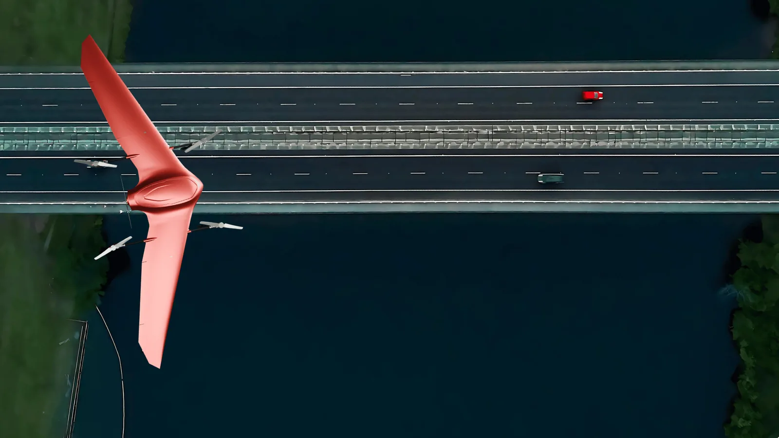
A network survey in progress. Traffic keeps moving underneath.
For public agencies & municipalities
Evidence that survives the audit.
A grant reviewer's first question is how much of the network the number covers. A sampled survey rates a fraction of it and asks the reviewer to trust the extrapolation. HALO AI scores every segment with the same model and the same ASTM D6433 math, so the capital plan is built on measurement of the roads it names. The scores arrive as condition data for the pavement management system your program already runs on, keyed to your own segmentation, so nothing has to be retyped or remapped.
- PCI for 100% of the network, so the capital planning cycle starts from measurement.
- Segment-level evidence to rank and justify maintenance spend.
- Year-over-year change tracking that shows where the money went.
- A lighter footprint for sustainability reporting: about 0.09 kg of CO2 per 100 km surveyed, against roughly 35 kg for a survey van (Fadron analysis).

For network maintenance contractors
The tender priced from quantities.
One capture pass covers the whole corridor, so the scope you price is measured rather than sampled, and the dated imagery behind it is what carries a change order at closeout.
At network scale
How much road a survey covers.
Plan on 5 to 30 ha per flight hour at road-survey resolution. Corridor layout and local flight rules move that figure more than the aircraft does, so we size the program against your network first.
Others have proven the method at that scale. Kuwait's Public Works Ministry mapped 1,000 km of major roads in six weeks in 2024, at 40% lower cost than its previous program. The City of Harrisonburg, Virginia covered 350 km of streets for potholes in three days in 2021. Both are independent third-party projects, not Fadron's.
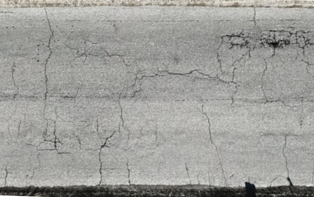
 Raw imagery
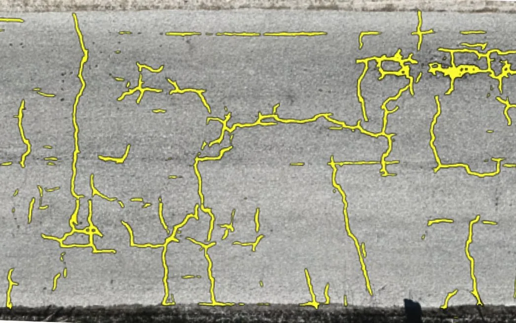
HALO AI detection
Raw imagery
HALO AI detection
Drag to compare the raw corridor imagery with the HALO AI segmentation of the same surface.
Shipped capabilities
What HALO AI finds across a network.
Every finding carries its type, severity, dimensions, and coordinates, so this year's screening becomes next year's project scope without going back to the site.
- Cracking taxonomy: longitudinal, transverse, and alligator, measured by length, width, and area.
- Potholes: count, area, and depth class per location along the corridor.
- Bleeding, flushing & rutting indicators: mapped by extent alongside the surface distress.
- Patch failures: existing patches rated, failing patches flagged for rework.
- Segment PCI & heat map: D6433 per segment, drawn as a color-coded network map.
- Change tracking: new and worsening distress, segment by segment, between surveys.
One flight, many layers
One survey, many answers.
The imagery you captured for PCI already holds more than the pavement. Each layer comes back on its own.
So when the repaint schedule or the sightline complaint reaches your desk next budget cycle, the answer is already sitting inside a flight you paid for.
One corridor, four data layers from a single capture.
Also available
Four more layers from the same flight.
Add any of them to your next survey, scoped corridor by corridor through the Early Access program.
Road marking condition survey
Centerline, edge line, and crosswalk visibility rated network-wide, so the repainting program is scoped from data instead of complaints.
Roadside vegetation encroachment mapping
Overgrowth on shoulders, verges, and sightlines flagged and located for maintenance routing.
Shoulder and verge condition assessment
Edge drop-offs and shoulder deterioration captured alongside the pavement data in the same pass.
Roadside asset inventory
Manhole covers, drainage inlets, and curbs detected and mapped into your GIS asset register.
Deliverables
What lands on your desk.
The council meeting, the tender, and the asset register each get their own file.
| Deliverable | What you do with it |
|---|---|
| Color-coded network map | The one picture a council meeting needs: every segment green to red, at a glance. |
| Segment PCI table (ASTM D6433) | Every segment scored and ranked, with the deduct values printed, so a challenge to the ranking is answered by re-running the arithmetic. |
| Measured distress inventory | Quantities by type and severity, ready for tenders, work orders, and treatment selection. |
| GIS exports (shapefile, GeoJSON, CSV) | Scores and distresses drop straight into your pavement management system. |
Delivered within 24 hours of upload. Judge the format for yourself on a real scored survey.
The resolution a corridor needs.
Engineering-grade ASTM D6433 scoring runs at about 5 mm/px, which any survey-grade drone can fly over a corridor, and vehicle-mounted capture is supported on request for carriageways that cannot be overflown. See what qualifies, or send us a sample stretch and we'll confirm.
FAQ
Road network survey questions.
A windshield survey is fast, and it is a rater scoring what they can see from a moving vehicle, usually across a sample of segments. Published inter-rater data puts two qualified engineers about 16% apart on the same pavement. HALO AI scores every segment from imagery with one model and one set of metrics. Agencies commonly keep the windshield program for triage and use HALO AI for the record that goes into the budget case. See inspection methods compared.
On request, yes. Drone capture is the standard workflow, and a vehicle-mounted rig is the practical option on a live carriageway you cannot overfly, provided it meets the resolution and georeferencing requirements. Send us a sample stretch and we will confirm.
Whatever segmentation your asset-management system already uses, so the scores load without remapping. If you do not have one, we agree it during scoping and hold it constant between surveys, which is what makes year-over-year change tracking mean anything.
The variables are network length, how much of it you resurvey each year, and which data layers you want beyond PCI. Most agencies start with the fixed-price pilot below, or see how pricing works.
Recommended start
The Pilot Inspection Program.
One corridor of your network, at a fixed price agreed before capture. The full terms are on the pricing page.
Score the whole network, not a sample.
If you are weighing this against the survey methods you already run, read the honest comparison. Otherwise, ask us for a 30-minute demo or start with a sample report.