Drone pavement analysis
HALO AI turns drone photos into a full ASTM PCI report.
Every pavement distress in ASTM D6433 and D5340 is traced, measured, and scored, from fine cracks to rutting and potholes. Upload raw photos from any survey drone and get the engineering report back within 24 hours, with the repair plan priced at your own unit rates.
Live survey
A real road survey, live in your browser.
This 768 m² road section scored PCI 13 out of 100, with ruts up to 42 mm deep, depressions up to 62 mm, and 183 L of standing water, all measured from the drone photos. Pan it, zoom in, and switch between the Ortho, Relief, and Shaded views.
The whole survey, sent to you.
Every section scored, the full distress inventory with every crack and deformation measured, and the PCI heatmap across the whole site. We will email you the link.
Full ASTM PCI
HALO AI scores every distress in the ASTM PCI standard.
Cracks, potholes, patching, and raveling are traced, and swells, bumps and sags, and depressions are measured in height and depth, all from the same drone photos.
Asphalt
ASTM D6433- Alligator cracking
- Block cracking
- Edge cracking
- Joint reflection cracking
- Longitudinal and transverse cracking
- Slippage cracking
- Rutting
- Depressions
- Bumps and sags
- Corrugation
- Shoving
- Swells
- Lane and shoulder drop-off
- Bleeding
- Weathering
- Raveling
- Potholes
- Patching and utility cuts
- Railroad crossings
Concrete
ASTM D6433- Corner breaks
- Divided slabs
- Durability cracking
- Linear cracking
- Shrinkage cracking
- Joint faulting
- Blowups
- Pumping
- Punchouts
- Lane and shoulder drop-off
- Joint seal damage
- Scaling and map cracking
- Popouts
- Corner spalling
- Joint spalling
- Large patches and utility cuts
- Small patches
- Railroad crossings
Asphalt
ASTM D5340- Alligator cracking
- Block cracking
- Joint reflection cracking
- Longitudinal and transverse cracking
- Slippage cracking
- Rutting
- Depressions
- Corrugation
- Shoving
- Swells
- Bleeding
- Weathering
- Raveling
- Jet blast erosion
- Oil spillage
- Patching and utility cuts
Concrete
ASTM D5340- Corner breaks
- Linear cracking
- Durability cracking
- Shrinkage cracking
- Shattered slabs
- Alkali-silica reaction
- Joint faulting
- Blowups
- Pumping
- Joint seal damage
- Scaling and map cracking
- Popouts
- Corner spalling
- Joint spalling
- Small patches
- Large patches and utility cuts
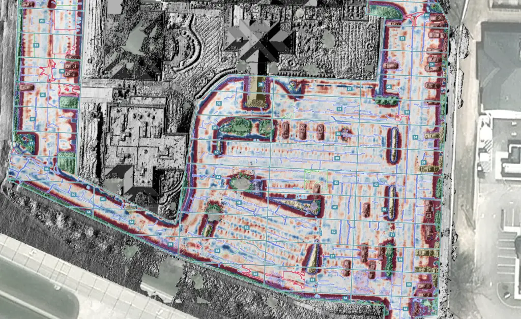
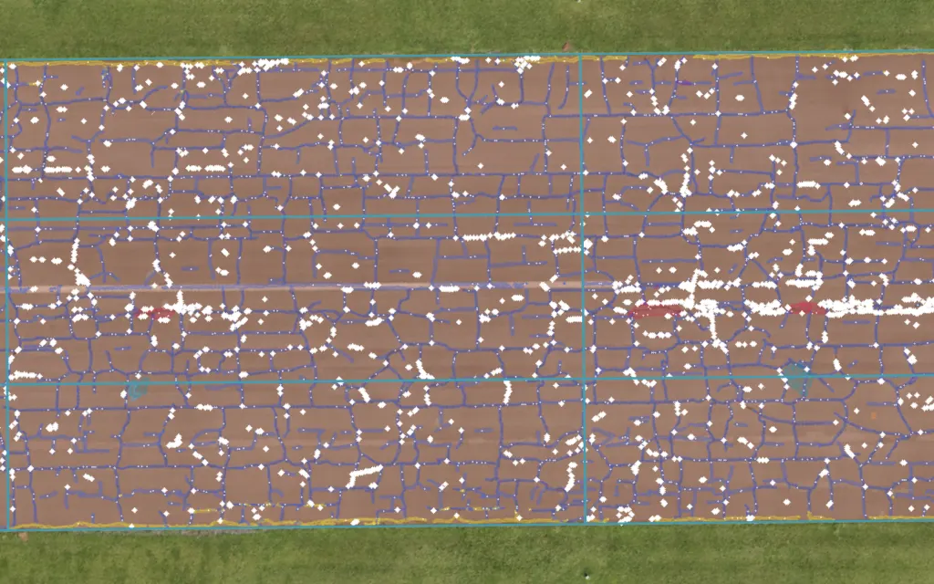
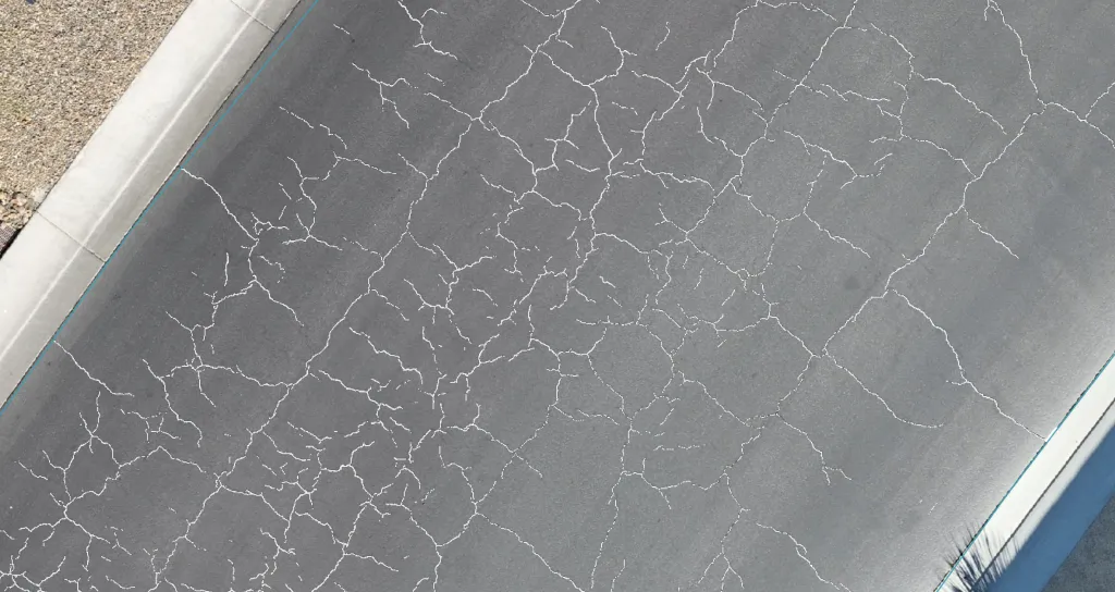
Every distress comes back measured:
- Lengths
- Widths
- Areas
- Depths
- Heights
- Volumes
Scored to ASTM D6433 on asphalt and jointed concrete, slab by slab on concrete, and to ASTM D5340 on airfields.
By asset: Roads & highways Parking lots & sites Airport runways Concrete & bridges Runway FOD detection
The report
Every HALO AI report comes with a priced repair plan.
Each survey becomes an engineering PDF: the PCI by section, a maintenance and repair plan, repair quantities priced at your own unit rates, the pavement's estimated age and remaining life, and its condition history across surveys.
One airfield report: 34,643 m², 155 sample units
The repair plan put surface seal, crack sealing, and patching in front of reconstruction, section by section, with every quantity priced.
Preventive repair runs about €12/m², against about €130/m² to reconstruct pavement after it fails (Fadron analysis). The plan shows which sections can still be saved at the lower price.
Exports to the systems you already run
- PAVER
- GeoPackage
- Shapefile
- GeoJSON
- KML
- DXF
- CSV
Anyone who was not on site opens the survey as an interactive map in the browser, in Ortho, Relief, or Shaded view, in metric or imperial.
HALO AI runs as a secure cloud platform, with private deployment available for large, security-sensitive organizations.
How it works
What happens between your upload and your report.
Stage 01
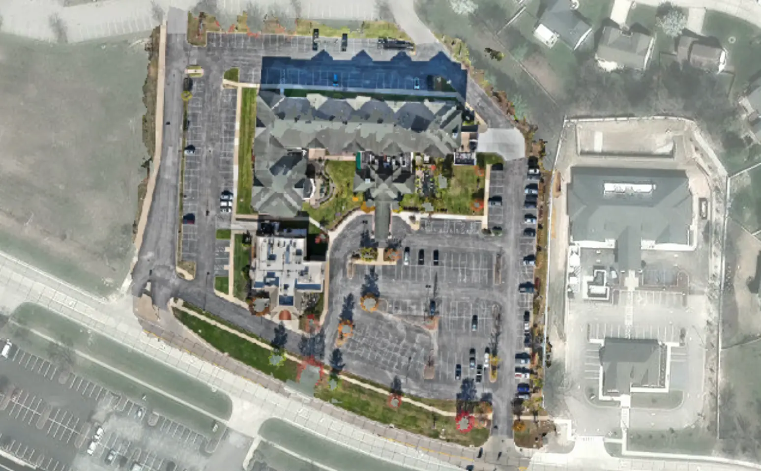
HALO AI turns your raw photos into a survey-ready map.
Upload the photos straight off the drone, or an orthomosaic you have already built. HALO AI does the processing before a single distress is scored.
- A sharp, calibrated orthomosaic of the whole surface
- A data-quality grade from A to D on every dataset
- Vehicles, vegetation, and curbs masked out, so only pavement is scored
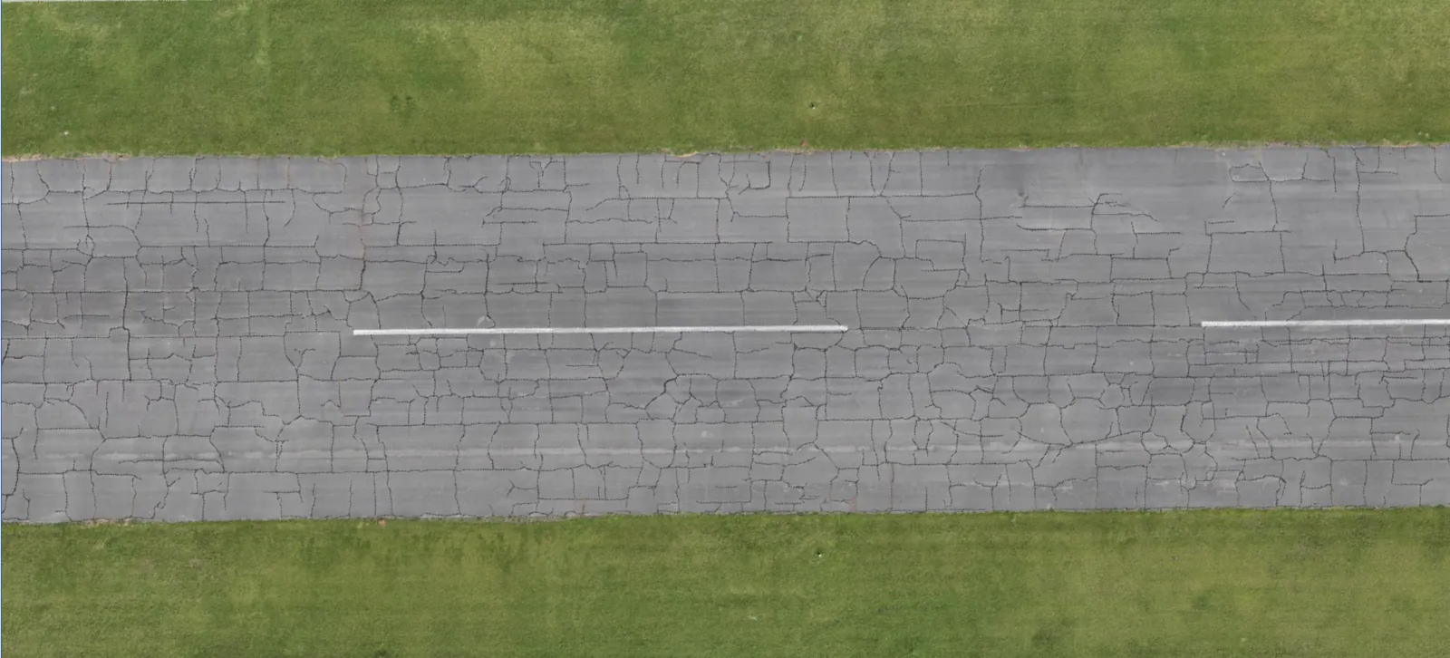
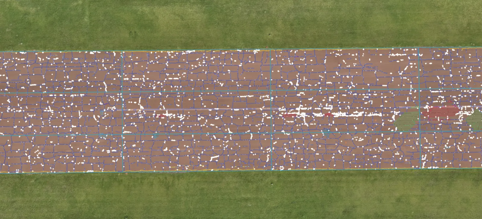 Raw imagery
HALO AI detection
Raw imagery
HALO AI detection
Stage 02
HALO AI traces every crack and measures every deformation.
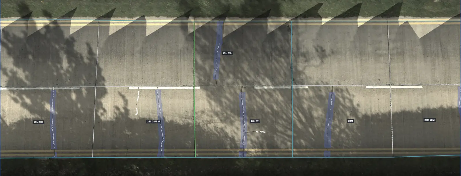
Cracks are traced at pixel level down to 1 mm wide, and each one comes back with its width, length, and area. Deformation is measured too: the depth of every depression, the height of every shove, and the step at every faulted joint. Standing water is mapped and totaled by volume.
HALO AI is trained on 1.8 million labeled samples from airports, highways, and parking sites.
Stage 03
Measured, then scored to the standard.
Every measured distress feeds the deduct values by type, severity, and density, and HALO AI scores each section to ASTM D6433 or D5340, slab by slab on jointed concrete. The score and the repair quantities come from one set of measurements.
- PCI per section, computed from 100% of the imaged surface
- Repair quantities totaled by distress type, in square meters and counts
The second survey is worth more than the first.
Fly the same pavement again and the report adds its condition history, section by section, survey after survey. One model scores every survey, so a change in the score is a change in the pavement.
One operator
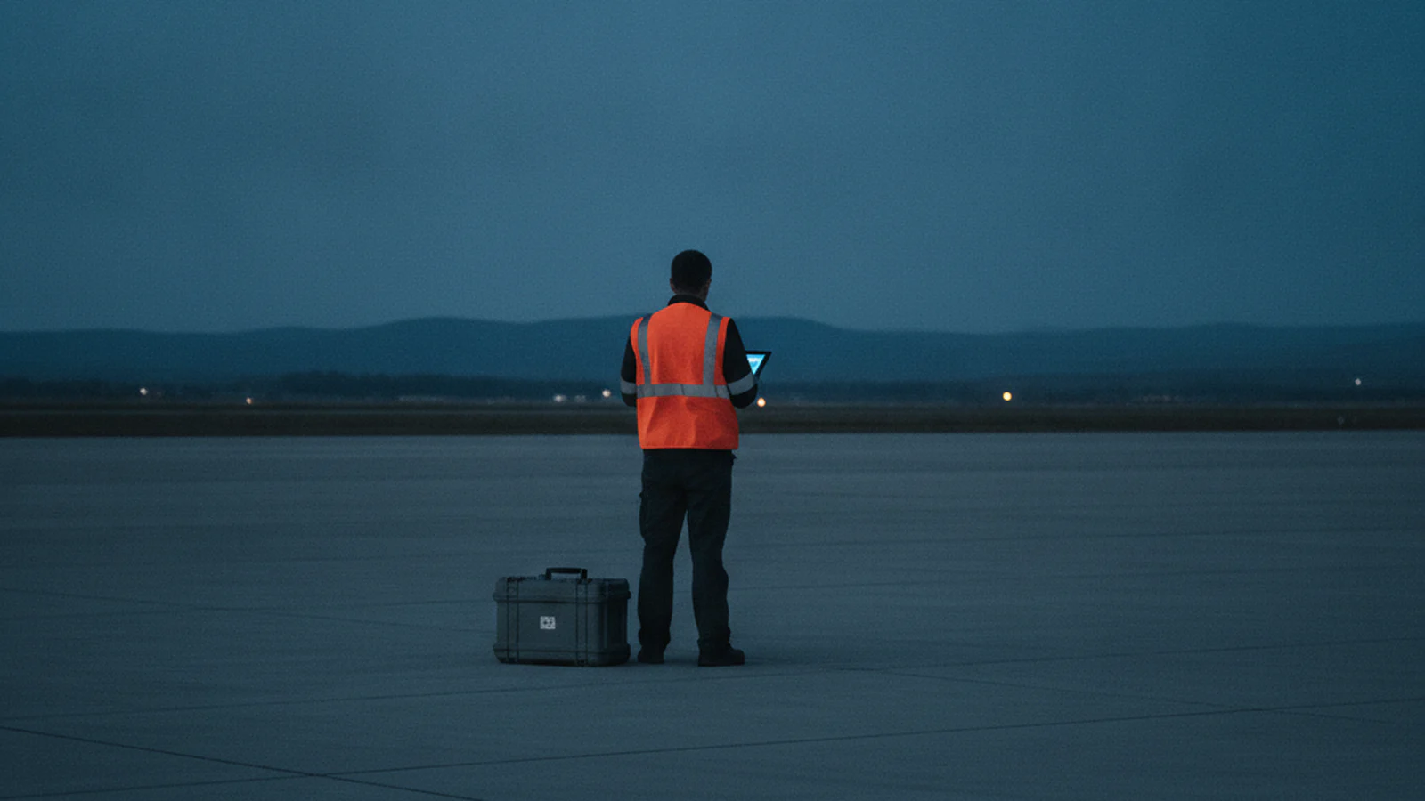
The analysis starts before you leave the site.
Upload from the field. Every step after the landing runs in the platform, so one operator carries the whole survey.
Accuracy
The best crack identification AI, and the numbers that say so.
Every crack HALO AI traces comes back with a measured width, length, and area, accurate to 98%.
The PCI built on those measurements agrees with qualified engineers' own scores for the same surface to 95%. Two qualified engineers scoring the same pavement by hand typically land about 16% apart.
When someone challenges a score, you open the map and show them the distress: traced, measured, and pinned to its coordinate.
Standards
The score your auditor already trusts.
HALO AI computes the PCI to ASTM D6433 for roads and parking lots and to ASTM D5340 for airfields, keyed to your own sections and ready to load into PAVER or the pavement management system you already run.
Your auditor can re-run the ASTM math by hand, from the printed deduct values to the maximum corrected deduct value.
Every input to that arithmetic is in the report: distress type, severity, and measured extent, per sample unit.
Outputs are built to support FAA Part 139, ICAO Annex 14, and EASA ADR records, and concrete analysis aligns with FHWA guidelines and ACI practices.
Your imagery
Fly any survey drone and upload the raw photos.
The platforms below already capture what HALO AI needs, and so do custom builds. Upload the photos as they come off the card, or an orthomosaic you have already processed. If you fly for clients of your own, the report becomes a deliverable you bill on top of the flight.
Resolution targets: about 5 mm/px for roads and parking lots, 3 mm/px for airfields, and 1 mm/px for concrete. At pavement resolution, plan on 5 to 30 ha per flight hour; a typical parking lot takes about 15 minutes to fly.
Our GSD calculator turns those targets into a flying height for the camera you already own, or a standoff distance where the surface is concrete.
FAQ
HALO AI platform questions.
Yes. HALO AI scores every distress in ASTM D6433 on asphalt and jointed concrete, and in ASTM D5340 on airfields. Cracking, potholes, patching, bleeding, and raveling are traced, deformation is measured in depth and height, and concrete is scored slab by slab. Standing water is reported too, by volume.
Both. From the same drone photos, HALO AI measures the depth of every rut, depression, and pothole, the height of every shove, swell, and faulted joint, and the volume of standing water. Nothing extra has to be flown or carried, and every deformation is scored to the standard alongside the cracks.
No. HALO AI works with photos from any survey drone, uploaded raw or as an orthomosaic you have already built. Nimbus is the aircraft we built for long survey flights, and it is optional.
Yes. HALO AI exports a PAVER inspection file in XML or XLSX, plus GeoPackage, shapefile, GeoJSON, KML, DXF, and a quantities CSV, keyed to your own sections so it loads without remapping. Your system keeps the inventory and the budget model, and HALO AI fills it with measured condition data.
Within 24 hours of upload. A parking lot is usually back the same day, in about three hours, after about 15 minutes of flying.
Yes. The report prints every input to the ASTM calculation, from each distress's type, severity, and measured extent to the deduct values and the maximum corrected deduct value, so an engineer can re-run the math by hand and land on the same PCI. Where a score has to carry a signature, the Engineer-Verified QA add-on puts a civil engineer's sign-off behind it.
Yes. The same survey that scores the PCI measures the height and depth of potholes, faulted joints, settled slabs, bumps and sags, and edge drop-offs, and reports standing water by volume. Every hazard is located with its photo and ranked by severity, which gives an owner a fix-first list and a dated record for insurers and claims. For parking lots, see trip hazards and liability.
The fastest way to feed HALO AI is the aircraft we built for it. Nimbus flight plans are tuned to these capture requirements, and the imagery lands in the platform with no integration step in between. Meet Nimbus.
See the full ASTM PCI on your own pavement.
Send us the link to an orthomosaic you have already flown and we will analyze 1 ha of it at no charge. The terms are on the pricing page.