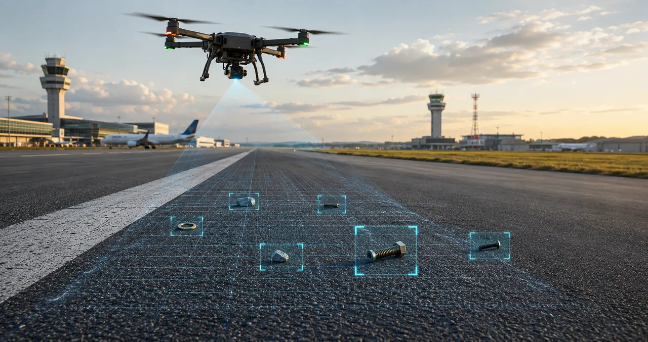
Runway FOD detection
Eight minutes over the surface. Every object on the map.
A drone survey covers the full width of the runway and taxiways and finds debris down to 5 mm, each item pinned to coordinates with a time stamp and its own image crop. Your clearance crew drives to the object instead of looking for it.
Updated: August 2026
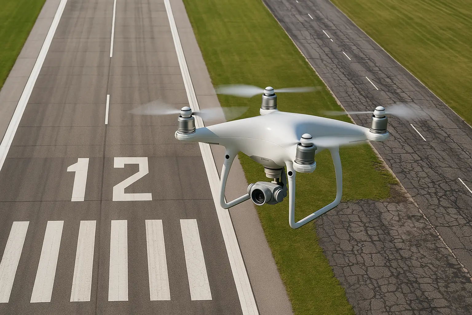
A FOD survey in its capture window.
How a survey runs
A short flight in a slot you already have.
The survey is coordinated with operations and ATC the same way a runway inspection is, and it fits an off-peak window. The aircraft flies the full width of the runway and taxiways at a fixed height and speed, so one pass is comparable to the last: run it after a construction phase, before a high-value movement, or on a standing schedule.
- Off-peak capture window, planned around your movements.
- Full runway and taxiway width, same height and speed, pass after pass.
- Every find logged with a coordinate and a time.
What it detects
The debris that ends up in an engine.
- Metal debris. Fasteners, tool fragments, and part-shed items, the objects most likely to damage an engine or a tire.
- Rubber and tire fragments. Shed rubber and pavement material that accumulates in touchdown zones and along high-use taxiways.
- Wildlife-attracting debris. Organic and food waste that draws birds onto the movement area, flagged before it becomes a strike risk.
Each detection carries its position relative to the centerline, a time stamp, and the imagery crop. The clearance crew goes straight to the object, and the record survives the shift change.
Why it works
What the survey produces every time.
Coverage
The far edge gets the same pass as the centerline, at four in the morning, at the end of a long shift, in the rain.
Consistency
Same flight profile, same model, every run. The first meter and the last are held to one threshold, so a change between two surveys is a change on the surface.
Records
When an insurer or an incident review asks what was on the surface and when, you open the file.
On-site processing
Analysis at the runway edge.
HALO Edge is a field station that runs the FOD analysis on the airfield: no cloud connection, no imagery crossing your perimeter, and no dependence on bandwidth you do not control.
It ships as part of a scoped deployment. Tell us your data-residency constraint and we will design around it.
FAQ
FOD detection questions.
Down to 5 mm. What sets the threshold is the pixel-on-target the flight achieves, and we fix that from the sensor and the altitude when we plan the profile for your surface.
No. The survey flies in an off-peak window coordinated with operations and ATC, occupies the surface for 3 to 8 minutes, and the movement area is released on the schedule agreed in advance.
No, and it is not sold as one. The daily self-inspection of the movement area stays with your ops team, because a UAS is not accepted as the sole means of performing it. What the survey adds is a full-surface record: the whole width covered in 3 to 8 minutes, every find down to 5 mm on a coordinate with a time on it.
Field-proven. FOD detection is our most operationally mature capability. The survey profile, the detection thresholds, and the reporting workflow on this page come from live airfield operations.
Yes. HALO Edge runs the analysis at the runway edge with no cloud connection and no imagery leaving your perimeter. It is built for airports with data-residency or security requirements, and for remote fields without reliable bandwidth.
Fixed radar and camera systems watch the zones they were installed to watch. A drone survey covers the whole surface on demand, needs no permanent installation, and can be rerun anywhere on the airfield. Airports run both: the fixed system for continuous watch, the survey for the full-surface record.
Yes. One off-peak flight feeds both. See airport runway inspection for ASTM D5340 PCI and the full condition report.
The variables are the movement area you want covered and how often you want it flown. Most airports start with the fixed-price pilot below, or see how pricing works.
Recommended start
The Pilot Inspection Program.
One runway and the georeferenced find log the survey produces, at a fixed price agreed before capture. The full terms are on the pricing page.
See what the next survey finds on your runway.
The same off-peak flight can feed a full condition survey. See runway inspection, or start with a sample report.