Photogrammetry vs. LiDAR for Aerial Mapping
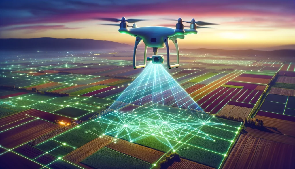
In the world of surveying, there are several techniques for collecting data. The technology you use depends heavily on what you will use the data for. Regarding aerial mapping, two technologies stand out as the most used and often the most effective: photogrammetry and LiDAR.
So, let’s say you have an upcoming UAV mapping project and are wondering which of these techniques is the best one to use. You have come to the right place as we will analyze what each method does and what it’s best used for.
What is Photogrammetry?
Photogrammetry refers to the activity of taking several photographs at different angles and with varying overlaps, then using specialized software to construct 2D maps, orthomosaics, 3D models, and DEMs, among other outputs. Photogrammetry has been in practice for a long time with manned aircraft, but the invention of UAS systems has made it even more accessible to industries that couldn’t afford it before.
What is LiDAR?
LiDAR stands for Light Detection and Ranging, a technology that relies on laser beams to measure distances. A LiDAR payload is attached to an aircraft system, and the oscillating mirrors send laser beams to the object that needs to be captured at specific intervals.
This system then measures the distance the beam travels once it is reflected back from the object. LiDAR generates point clouds that form the exact shape of the captured object. However, LiDAr doesn’t work alone. For it to be effective, GPS or GNSS systems have to be in place, as well as an accurate IMU (Inertia Measurement Unit).
Photogrammetry vs. LiDAR: What are the Differences?
Now that we know how both technologies work let’s compare them based on the factors to consider when choosing an aerial mapping method.
Accuracy
Generally, LiDAR data is more accurate than photogrammetry, and the difference stems from how the data is collected. For photogrammetry, we rely on cameras to take the photos. However, it is possible to collect inaccurate data in cloudy conditions, poor lighting, or areas with very thick vegetation.
The payload used also affects the accuracy of the data collected. Professional payloads with mechanical shutters, such as the ones on the DJI Mavic 3 Enterprise, would be an excellent place to start if you want accurate photogrammetry data. While you could use PPK and RTK systems to improve the accuracy of photogrammetry data, the factors mentioned earlier still apply.
On the other hand, since LiDAR relies on sending pulses, the data you get from it tends to be more accurate. This is because these pulses will go through clouds and even thick vegetation. However, these pulses don’t go through solid objects, so if light can’t go through, LiDAR systems won’t be effective.
Coverage
How much ground either of these systems can cover depends on the platform you are using. In some cases, photogrammetry can cover more ground, especially when you are using fixed-wing, VTOL, or eVTOL drones that can fly at higher altitudes and for longer. You could cover even more ground with LiDAR when flying at higher altitudes since LiDAR sometimes has a larger field of view, but you could compromise on the quality of data collected.
For the highest accuracy of LiDAR data, it’s advisable to fly slowly and at lower altitudes, covering less ground at a time. Besides, you should also consider the area you are flying in. In Europe, for instance, the highest you can fly in the open category is 120 meters, flying higher will require a special license or approval.
To cover more ground for both techniques, you could use several drones with proper fleet planning so you don’t crash into each other. In future, drone swarms could be the norm where you can control several drones for mapping or any other activity from one center.
Ease of use
Photogrammetry has a more streamlined user experience. As long as you have the right sensor and follow the proper steps in preparing and collecting the data, software like Agisoft, Pix4D, or DroneDeploy will process the data for you and give you usable deliverables. On the other hand, LiDAR is more complex and needs more expertise to deal with it.
Deliverables
The deliverables you get can also help determine which technique to use. With photogrammetry, you can get clear orthomosaics and 3D models, making it ideal for presenting external features such as buildings or disaster-stricken areas. LiDAR outputs dense point clouds that show the objects being captured. While you could colorize them to understand them better, the result may be of lower resolution than that from photogrammetry. However, these point clouds are quite good at portraying terrain or showing the object’s actual surface.
Processing Speed
Processing photogrammetry data sometimes takes a long time, especially when processing on a desktop PC. Processing 100 acres (40.5ha) with 8 GB RAM 1 TB ROM PC,takes a week to complete. Same processing with a 64 GB RAM, took just a few hours. You need high processing power to get the outputs in a few hours. On the other hand, LiDAR is faster since you can get the 3D point cloud as soon as the drone lands for small projects, though large projects could consume some time to process.
Cost
While it has been possible to make smaller payloads to use on drones, these systems are still quite expensive. If you are looking for a cheaper way to collect data, photogrammetry is relatively cheaper than LiDAR. As long as the drone you have has a camera, it is possible to use it for photogrammetry. However, professional work requires high-quality sensors that aren’t cheap but still more affordable than LiDAR.
Applications
Based on how they work and their strength and weaknesses, below are the best applications for each;
– Photogrammetry – Photogrammetry works best for creating 2D orthomosaics, DEMs, and 3D models of areas with little to no vegetation or anything that could block the camera. This technique will be perfect if you want to visualize an architectural project or monitor vegetation change.
– LiDAR – Due to its ability to penetrate vegetation, LiDAR works best for forest management, vegetation mapping, terrain mapping, infrastructure mapping, and inspection of assets like roads, cell towers, and utility corridors.
Technological Advancements
Since man was able to take to the skies with planes, various industries have been thinking about how aircraft systems could help them. One of these industries is the surveying industry.
Fast-forward to the introduction of drones, and engineers have managed to make photogrammetry and LiDAR payloads small enough to fit on drones. Technology that was once only used in the military is now available to enterprise and consumer users. Further technological advancements, such as AI and 5G, are making it possible to automate the mapping and processing workflow, minimizing time while enhancing accuracy.
Through machine learning, it’s possible to train a model to detect certain objects on a map or in a live feed, such as buildings, people, or animals. This works well for surveillance, precision agriculture, monitoring, detecting changes in landforms, or creating a more understandable digitized presentation of the data generated from the aerial mapping process.
Services like One3D.ai allow you to collect and upload images to the cloud for real-time processing, which is even more efficient with 5G. Besides data collection, LiDAR is also used in UAS systems to detect and avoid obstacles, and it works better than infrared-based systems.
Final Thoughts
And there you have it. Both photogrammetry and LiDAR have their advantages and disadvantages. Your choice should depend on the project, the area you will be mapping, your desired deliverables, and your budget. If possible, you can combine them since they both deliver unique insights.