From Flight Planning to Data Analysis
A Step-by-Step Process for Advanced Drone Data Collection in Large Infrastructure Projects
In previous posts, we discussed how drones have become crucial for different phases in constructing large infrastructure projects. Today, I want to get technical and show you how exactly you can collect data, process it, and extract valuable insights. Like any project, drone data collection requires lots of planning and a structured workflow, and this article will help describe one. Whether you have never used drones before or have used them but are still determining how the data collection aspect works, this article is for you.
Preflight Preparation
Before conducting any drone operation, you need to conduct a preflight preparation. This involves;
Defining Survey Objectives
You need to meet with the stakeholders and understand their intentions for the survey, the types of deliverables they want, the GSD (ground sampling distance) of the survey, and any other information they are prepared to give. The most common deliverables for construction projects may include contour maps, DEMs, DSMs, point clouds, 3D models, LiDAR maps, etc. Each phase of the construction may require different deliverables.
Choosing the Equipment
Once you confirm what the client wants, you can choose the best equipment. The GSD or resolution can help you decide on the payload to use, while the acreage of the area and deadline can help you decide on the type of drone you want to use. For multirotor drones, DJI drones like the DJI Matrice series, especially the M300 RTK and M350 RTK, are the best for large infrastructure projects. For fixed-wing and VTOL, check out Sensefly and Wingtra, respectively.
Site Assessment and Regulatory Compliance
It would help if you visited the area of interest to assess any perceived risks to the drone operations or any risks your drone operations may have on the surroundings. While there, observe the terrain, wind strength and direction, and temperature, as these will affect drone operations. If you need more time to develop a pattern, you can ask the locals for this information. You also need to ensure the area is not within a No-Fly zone and gather any permissions you need before commencing the drone operations.
Flight Planning
After gathering all the necessary information, it’s time to create flight plans. This involves;
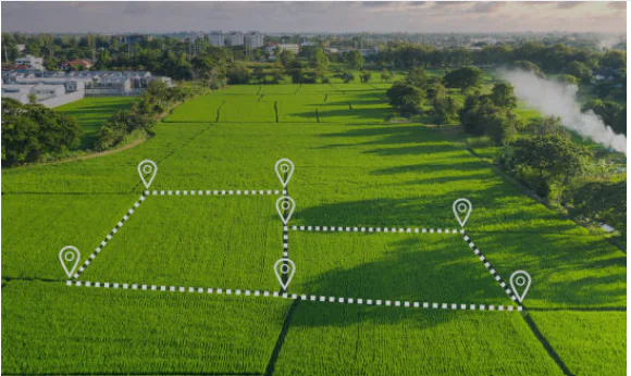
Determine the Area of Interest
I prefer using Google Earth Pro to visualize the area of interest and determine the boundaries. For a large infrastructure project, the client will probably have a KML or shapefile of the area of interest.
Pick and Appropriate Day to Fly
Once you determine the boundaries, you can use weather forecasting apps like UAV Forecast and Windy to decide the best day to fly. A good day to fly would be one with a lot of sunlight, fewer clouds, enough satellites, and one where winds aren’t too strong.
Set Flight Parameters
With information on the terrain, weather, and the GSD the client wants, you can set flight parameters such as altitude, flying speed, and overlaps. Some clients will provide the percentage of overlap they want, but you can decide on one if they don’t.
Incorporate GCPs
To ensure accuracy, you need to establish Ground Control Points and clearly mark them so that they are visible on the drone images. While drones are generally accurate, thanks to GPS and RTK or PPK systems, they still may not provide data that is accurate enough for surveying work. To improve this accuracy, you need to establish GCPs using highly accurate devices and use them to georeference the drone images. Other best practices for placing GCPs include;
– Distribute them all over the area of interest. Avoid clustering or overlapping them.
– Place some GCPs along the edges and others in elevated areas to ensure overall accuracy.
– Place the GCPs on stable surfaces.
– Have enough GCPs (at least 5 – 10 in 1 KM Square).
Data Collection
Preflight Checks
Prepare a checklist of all the items you need and use that to prepare for every flight. Before flying, you should also check the drones, batteries, payloads, and other accessories for damage. Check if you have enough storage devices, and if you will be in a place with no power, make sure you have enough batteries or a charging station.
Conduct Test Flights
Conduct a few test flights to make sure the UAVs are working correctly and determine if they need calibration. You can also collect sample data and process it on-site to gauge the resolution.
Data Capture
Once everything is good to go, you can start executing the flight plans to collect the data. During the survey, observe the UAVs’ performance, looking for weather, temperature, and altitude changes and how they respond to them.
Post-Flight Checks
Review the collected data and make sure it is enough. If you can, process it on-site, gauge the output, and check for any gaps. If you collect too many images, it may take hours to process, but software like Metashape and Pix4D have a low-resolution processing option that will be completed quickly, providing a quick glimpse of the mapped area. You would want to avoid getting to the office and realizing you have gaps and have to go back to the field to fill those gaps.
Data Processing and Analysis
Drone data is raw, lacking structure, and unusable on its own. To extract something useful from it, you need to process it.
Processing Software
When planning, you select the right drone, payload, and software so you will produce the appropriate deliverables for the project at hand. The best software you can use for processing drone data includes;
– Pix4D – Best for creating orthomosaics, 3D meshes, and point clouds. It supports customization and also has a suite of cloud-based platforms that speed up data processing.
– DroneDeploy—This is another excellent processing software that has a whole suite of tools for processing drone data. DroneDeploy is cloud-based, too, speeding up the processing software and allowing collaboration and near-real-time reporting as it collects the data and uploads it for processing.
– AgiSoft Meta Shape – Works best for 3D model reconstruction and is also great for producing point clouds and orthomosaics.
– ArcGIS Drone2Map—If you’d like to do further analysis, Drone2Map is a good option. It integrates with Esri tools like ArcGIS, allowing you to produce land cover maps, DEMs, and contours.
– DJI Terra—This software is designed for DJI drones. It allows you to quickly plan and execute drone flights and visualize the results. If you collect LiDAR data with a DJI drone, DJI Terra is the best option for reconstructing it before using any other software for analysis.
– LiDar360 – This is another software for processing LiDAR data.
– GlobalMapper – This is another software that you can use to analyze drone data. The Pro version also allows you to process LiDAR data.
Processing Techniques
Each software has its process, but the outputs you get are almost similar. So, let’s discuss what you should aim to produce from drone data.
– Orthomosaic generation – This involves stitching the images to produce a 2D map. This map can then be used for planning, site inspection, or to update topographic maps.
– Digital Elevation Models—These help provide information on the terrain and elevation of the area of interest, which can be useful in construction design and urban planning.
– Point Cloud Generation – This involves converting 3D coordinates to dense point clouds that form the shape of the objects on the ground. These help in measurements and volumetric calculations.
– 3D Modelling—Drones can help produce detailed 3D models, which can be used as digital twins or integrated into BIM.
Best Practices
Below are some things you can do to get the most out of your data.
– Optimize your mapping process to ensure adequate overlaps and to ensure all areas are covered.
– Validate the data collected and remove any gaps, distorted images, and any images with issues, as these will affect the overall output.
– Invest in high-quality hardware and software to streamline the data collection and processing process.
– Leverage automation for speed and efficiency.
– After processing and analysis, tailor the deliverables to the stakeholders’ needs. Software like ArcGIS, GlobalMapper, and QGIS are good for visualization.
Conclusion
A lot goes into collecting drone data and processing it into usable outputs, but I have done my best to put it all together in this post. You need to invest in the right drone, software, and skill. Anyone can operate software, but knowing what to do with what you get matters, so if you are not a surveyor or engineer yourself, collaborate with these professionals to ensure the data you collect is meaningful and actionable.