Top 5 Drone Photogrammetry Cameras for 2025
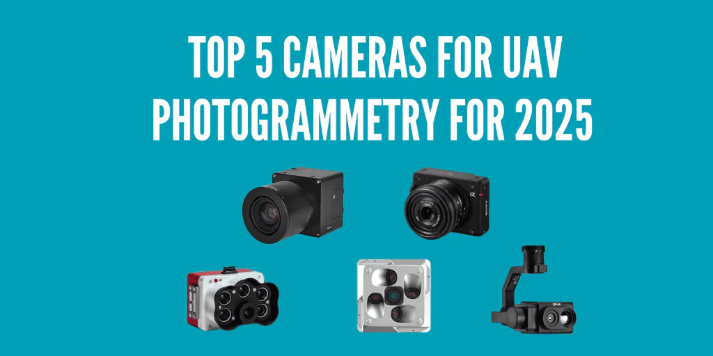
Getting crisp aerial maps and accurate 3D models depends on one thing above all else: the right camera. In 2025, these five cameras are prime choices for drone photogrammetry—covering everything from high-resolution RGB to multispectral and thermal imaging, plus oblique setups for comprehensive 3D modeling.
1. Phase One iXM Series (Ultra-High Resolution)
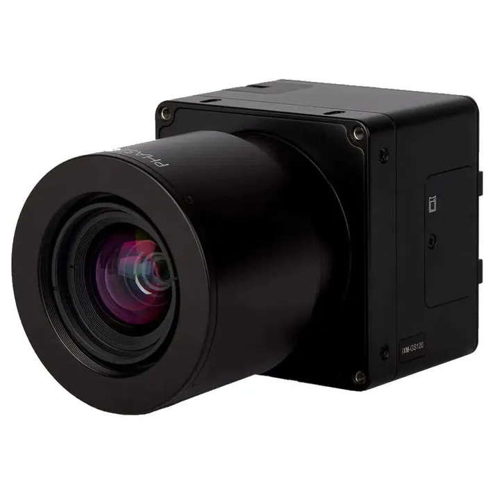
When it comes to premium image quality, the Phase One iXM Series still leads the pack. Available in 50MP, 100MP, and 150MP sensor variations, these cameras are built for the most demanding mapping and surveying tasks.
Key Benefits:
- Exceptional dynamic range to capture details in varying light conditions.
- Rugged build suited for industrial and commercial drone applications.
- Interchangeable lenses for tailored focal lengths.
Why You’ll Love It:
If your clients or projects demand the absolute best in detail—like cadastral mapping or industrial inspections—the iXM Series is your go-to for unparalleled clarity and color fidelity.
2. MicaSense RedEdge-P (Multispectral Marvel)
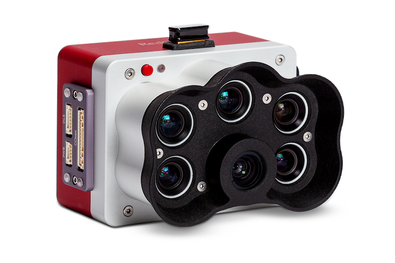
For insights beyond what the naked eye can see, the MicaSense RedEdge-P captures data across multiple spectral bands (blue, green, red, red edge, and near-infrared). It’s a top pick for agriculture, environmental monitoring, and land management in 2025.
Key Benefits:
- Five bands for precise vegetation indices (NDVI, NDRE, etc.).
- High-speed imaging reduces time in the field.
- Compatible with many professional drone platforms.
Why You’ll Love It:
Whether you’re optimizing crop yields or tracking forest health, RedEdge-P data delivers actionable insights that standard RGB cameras simply can’t match.
3. Sony ILX-LR1 (Industrial-Grade RGB)

Sony’s ILX-LR1 is a lightweight, 61-megapixel full-frame camera designed specifically for drones and industrial use. Its compact form factor and robust build make it perfect for those who want high-resolution RGB imagery without the bulk of larger camera systems.
Key Benefits:
- 61MP sensor for ultra-detailed orthomosaic and 3D model generation.
- Global shutter-like performance with minimal rolling shutter artifacts (due to fast readout).
- Streamlined design reduces weight for longer drone flight times.
Why You’ll Love It:
It’s Sony’s answer to high-end aerial photogrammetry needs—big resolution in a compact package that’s easier to mount on various drone gimbals.
4. Riebo DG6Pros2 (Oblique Master)
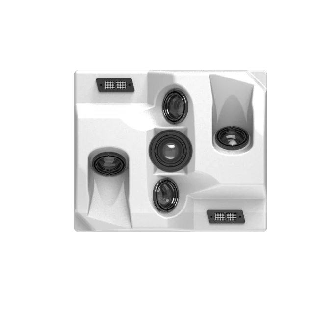
Formerly known under a different brand, the Riebo DG6Pros2 stands out for oblique photogrammetry, capturing images from multiple angles (typically four oblique + one nadir camera) in a single flight. This is a must for detailed urban mapping and architectural 3D modeling.
Key Benefits:
- 5-lens configuration (4 angled + 1 downward) for comprehensive coverage.
- Cuts down flight time by capturing multiple perspectives simultaneously.
- Produces high-quality 3D models with less overlap required.
Why You’ll Love It:
If your projects involve dense urban environments, historical building surveys, or real estate developments, oblique imagery captures every façade detail in fewer flights.
5. FLIR Vue TZ20 (Thermal Precision)
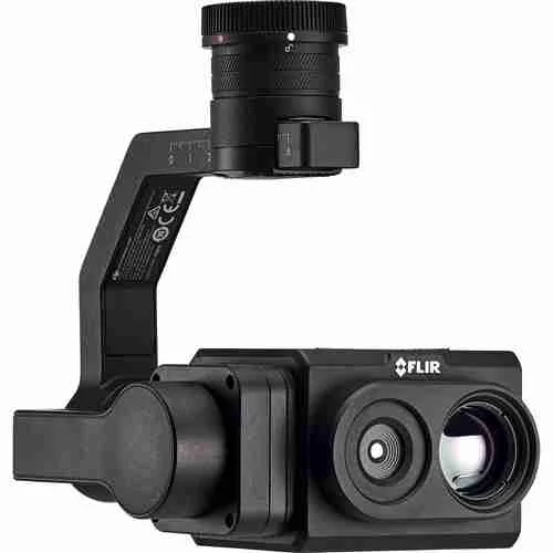
Thermal imaging is increasingly important in search and rescue, infrastructure inspections, and environmental surveys. The FLIR Vue TZ20 offers a dual thermal zoom payload designed for drones, giving you detailed thermal maps and letting you see hotspots or temperature variations quickly.
Key Benefits:
- Dual thermal zoom for close-up inspection.
- Lightweight, easy to mount on compatible drone platforms.
- Ideal for identifying heat leaks, solar panel defects, or missing persons in SAR missions.
Why You’ll Love It:
Thermal data adds another layer of insight—crucial for industrial maintenance and safety applications where standard RGB cameras can’t reveal hidden temperature anomalies.
Elevate Your Aerial Surveys in 2025!
Selecting the right camera is pivotal for next-level photogrammetry. From high-resolution RGB to multispectral, oblique, and thermal imaging—these five cameras will help you stay ahead of the curve in 2025.