Parking lots & paved sites
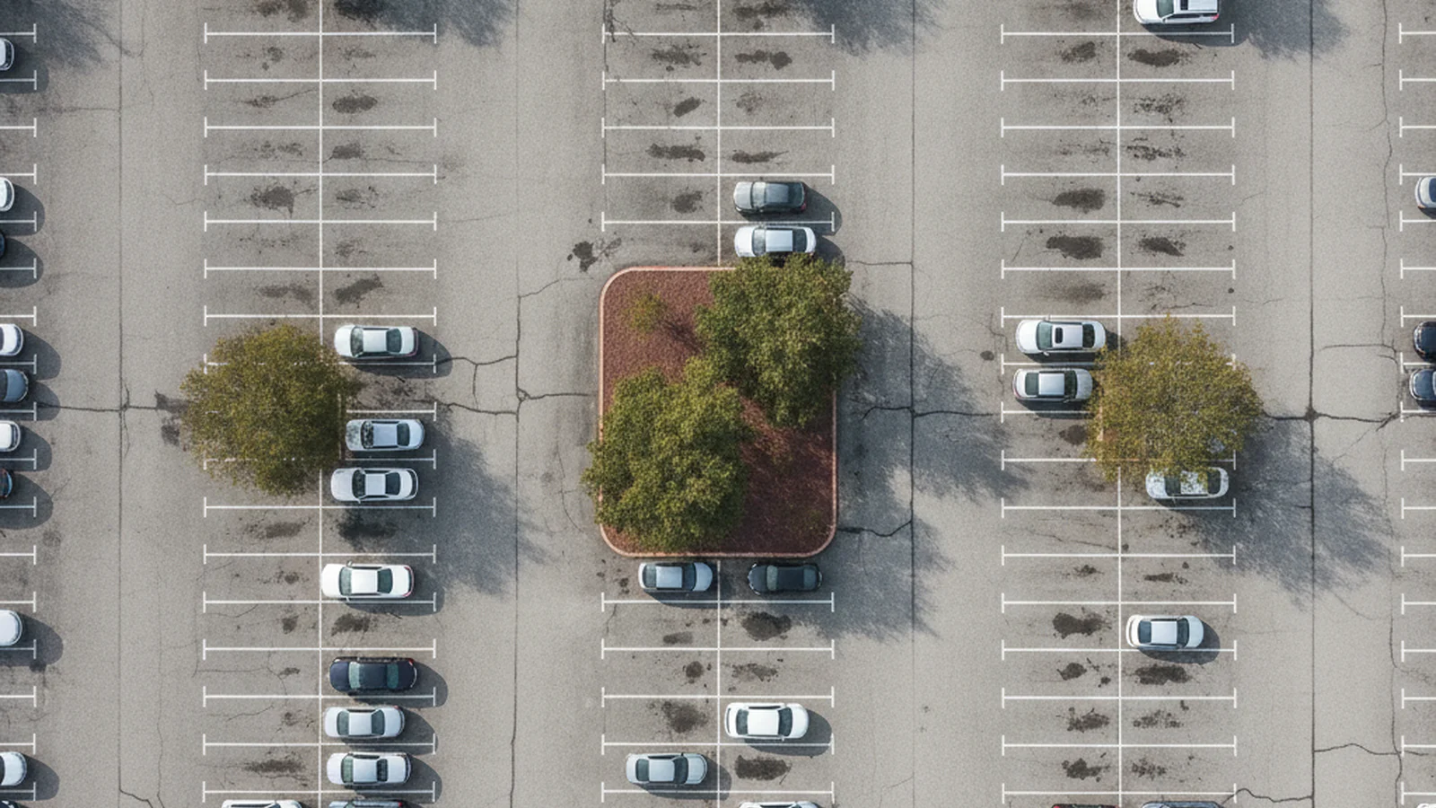
Parking lot inspection from a 15-minute drone flight.
HALO AI turns the flight into an ASTM D6433 condition report, most lots back the same day, with quantities you can drop straight into a bid, a budget, or a change order.
Updated: August 2026
The platform, live
A real lot, scored.
This is a parking lot in HALO AI, not a screenshot of one. Every colour on the surface is a scored section, and every distress under it was measured off the imagery.
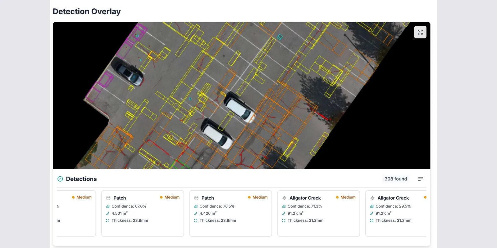
HALO AI's detection overlay on a real lot: each patch and alligator crack traced, with its measured area beside it.
For paving & construction contractors
A bid takeoff, measured from the air.
The lot never closes. Fifteen minutes of flight time comes back as a complete measured inventory: every crack, pothole, and failed patch with its dimensions and its coordinates. You price from quantities in square meters, each one traceable to the dated frame of the surface it came off.
- A bid takeoff the same day: repair quantities by defect type, in square meters and counts.
- Change orders that hold, backed by dated, georeferenced imagery.
- Pre-existing conditions on the record before you break ground.
- Before and after surveys that close out warranty questions.
For asset owners & property managers
One standard across every lot you manage.
A portfolio gets assessed by whichever contractor is standing on it, which is why two similar lots come back with different verdicts and different quotes. HALO AI runs the same model and the same ASTM D6433 math on every site, every year.
- Rank the portfolio: a PCI per lot, ordered by condition and the cost of waiting.
- Check every quote against measured quantities.
- Confirm the work you paid for with a survey before and a survey after.
Every year of waiting is a decision, whether or not anyone made it.
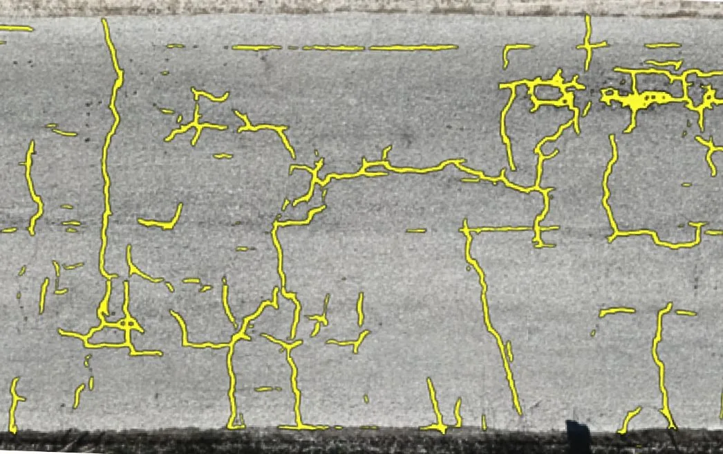
HALO AI crack segmentation on asphalt. Every trace becomes a measured row in the quantities table.
Shipped capabilities
What HALO AI finds on a parking lot.
Nine PCI distress types, each with its dimensions, its severity, and its coordinates.
- Longitudinal, transverse & alligator cracking: detected from 1 mm, with length, width, and area measured to 98% accuracy.
- Potholes: count, area, and depth class per location.
- Patch condition: existing patches rated, failing patches flagged for rework.
- Raveling, bleeding & distortion: mapped by extent and severity.
- Sealed vs unsealed cracks: sealing condition drives both severity and budget, so it is detected and recorded.
- Change vs the previous survey: new and worsening defects tracked between inspections.
Deliverables
What lands on your desk.
Sorted by the person who uses it. Nothing arrives as raw pixels.
| Deliverable | What you do with it |
|---|---|
| ASTM D6433 PCI report (PDF) | The deduct values and the max CDV are printed in it, so your client's engineer re-runs the arithmetic by hand and lands on your number. |
| Measured quantities table | Your bid takeoff: square meters and counts by defect type and severity, ready to price. |
| Annotated defect map | Walk the client through the lot without walking the lot. |
| GIS exports (shapefile, GeoJSON, CSV) | The inventory, straight into your asset-management system. |
| Interactive digital twin (optional) | A clickable model for everyone who was not on site. Each pin opens the photo and the measurements. |
The document a six-figure engineering survey produces, from fifteen minutes of flight time. Judge the format yourself on a real scored survey.
The resolution a lot needs.
Engineering-grade ASTM D6433 PCI on asphalt runs at about 5 mm/px, which any survey-grade drone can fly over a lot. See what qualifies, or send us a sample and we'll confirm within 24 hours whether it does.
FAQ
Parking lot inspection questions.
A lot is image-only work with no terrain model to build, so it runs in about three hours and comes back the same day you flew. Fly in the morning, price the job in the afternoon.
No. Capture happens from the air over a working lot: no cones, no lane taping, nobody walking between parked cars. HALO AI detects vehicles in the imagery alongside the distresses, and where a site is heavily parked we plan the window with you.
High-resolution, georeferenced imagery at about 5 mm/px ground sampling distance, which is what makes the PCI hold up in an engineering review. Any survey-grade drone produces it over a lot. See the requirements on the HALO AI page.
A walking survey samples a share of the surface and estimates the rest. HALO AI measures all of it, and every defect arrives located and quantified. See the full breakdown in our inspection methods comparison.
Yes, both, out of the same imagery. Marking condition is rated across stalls, crosswalks, accessibility symbols, and fire lanes, and vertical displacements are measured along pedestrian routes, which is dated evidence on the day a claim arrives. Ask us to add either one to your next survey through the Early Access program.
Yes, and consistency across sites is the reason to do it that way: the same model and the same metrics on every lot, every year, so the ranking is comparable. Portfolios run under an annual license. See pricing.
The variables are total paved area, how many sites, and how often you resurvey. Most clients start with the fixed-price pilot below, or see how pricing works.
Recommended start
The Pilot Inspection Program.
One lot, at a fixed price agreed before capture. The full terms are on the pricing page.
See what HALO AI finds on your lot.
See the exact report a lot like yours produces, then run the numbers on one site of your own.