A Complete Guide to UAV Photogrammetry for Pavement and Airport Inspection
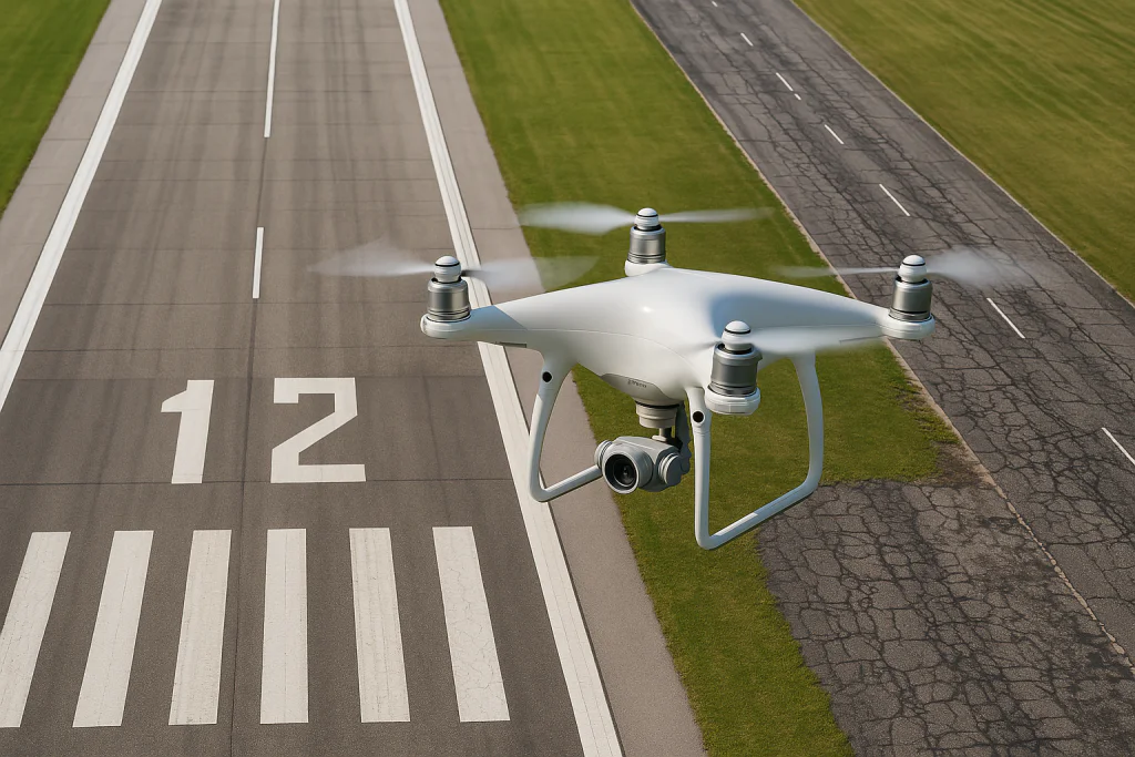
UAV photogrammetry is one of the most precise ways to inspect pavement surfaces, runways and taxiways. When done correctly it produces sharp orthomosaics and digital surface models that allow accurate PCI scoring and AI based crack detection. This guide focuses on practical steps that consistently work in real field conditions.
1. Why Photogrammetry Works for Pavement
Photogrammetry converts overlapping images into a flat and measurable map. Pavement inspection benefits from this because:
• Cracks, ruts and other distresses are visible as geometric features.
• Orthomosaics provide accurate measurements and repeatable results.
• The workflow can be repeated over time for trend analysis.
The most important factor is ground sampling distance. For pavement, aim for 0.1 to 0.4 cm per pixel. Higher values reduce crack visibility.
2. Camera Settings That Actually Matter
Dark asphalt, glare and low texture make pavement challenging. These camera settings produce the best results.
Shutter speed
Use the fastest shutter the camera allows. For VTOL drones that fly 15 to 18 m/s, shutter speeds of 1/2000 to 1/3200 help avoid motion blur. Even 1/4000 is fine if your sensor supports it.
Aperture
Use f5.6 to f8. These values keep the image sharp across the frame.
ISO
ISO 100 is often unrealistic, especially when flying fast. It is acceptable to use ISO 200 to 800 or even 1000 if needed. Noise is not a big problem for pavement because cracks and surface defects stand out clearly even in noisy images. Motion blur is far more damaging than noise.
Focus
Use manual focus set close to infinity. Autofocus often fails on uniform pavement.
Image format
JPEG is usually the best choice. RAW slows down the workflow and gives limited benefits for pavement texture.
3. Flight Planning for Accurate Pavement Mapping
Photogrammetry on pavement is different from mapping buildings or roofs. Here are the essential parameters.
Altitude
• Multirotors: 20 to 35 meters
• VTOL fixed wings: 40 to 70 meters
Altitudes depend on lens and sensor, but the goal is to maintain the required ground sampling distance.
Overlap
• Forward overlap: 85 percent
• Side overlap: 80 percent
This is needed because pavement lacks texture.
Flight speed
• Multirotors: 4 to 7 m/s
• VTOL fixed wings: 15 to 20 m/s
These speeds are safe as long as the shutter speed is fast.
Flight direction
Use a grid pattern with one cross route if possible. Crossing angles help reconstruction even on flat surfaces.
4. Light Conditions Matter More Than Expected
Pavement reflects light and creates glare that hides cracks. Use these guidelines:
• Slight overcast produces the best results.
• Avoid strong shadows from buildings and light poles.
• Avoid flying with the sun low on the horizon.
• Midday flights are acceptable if glare is not too strong.
Consistency is more important than perfect conditions, especially in airports where timing is limited.
5. Ground Control Points and Accuracy
For airports and large infrastructure it is important to maintain scale accuracy.
Recommended control point distribution:
• 6 to 10 GCPs for small areas
• For runways, place GCPs every 300 to 500 meters on both sides
• Add 2 to 3 independent checkpoints to verify accuracy
Typical accuracy ranges:
• Horizontal: 1 to 3 cm
• Vertical: 2 to 5 cm
These values are more than enough for PCI and AI analysis.
6. Common Mistakes to Avoid
Three issues cause almost all failed pavement datasets:
Motion blur from slow shutter speeds.
Autofocus missing on uniform pavement.
Glare that hides surface details.
Other common issues include:
• Altitude too high.
• Overlap too low.
• Worn or misaligned gimbals causing tilt inconsistencies.
7. Producing High Quality Orthomosaics
Good pavement orthomosaics have sharp texture, no seam lines, and straight markings.
To achieve this:
• Remove blurry images before aligning.
• Run alignment on high accuracy settings.
• Use camera optimization.
• Apply GCPs for scale correction.
• Avoid aggressive smoothing filters. Texture is important for crack detection.
8. From Orthomosaic to PCI and Crack Detection
AI systems perform best when imagery is:
• Sharp across the frame
• Captured in consistent light
• Scaled correctly
• Captured at nadir
If the capture process is controlled, AI provides consistent and repeatable PCI scores and distress measurements.
9. Summary
For reliable pavement and airport inspection results, follow these principles:
• Fly low to achieve sub half centimeter GSD
• Use high overlap
• Keep shutter fast and ISO flexible
• Use manual focus
• Avoid glare
• Use GCPs where accuracy is needed
High quality photogrammetry produces the best datasets for AI based inspection. A strong data capture workflow ensures accurate PCI scoring and enables predictive maintenance planning.