Drone Damage Assessment After Natural Disasters: Speed, Data, and Decision-Making
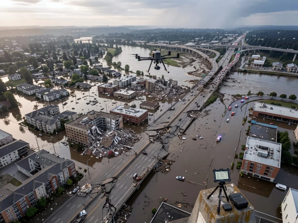
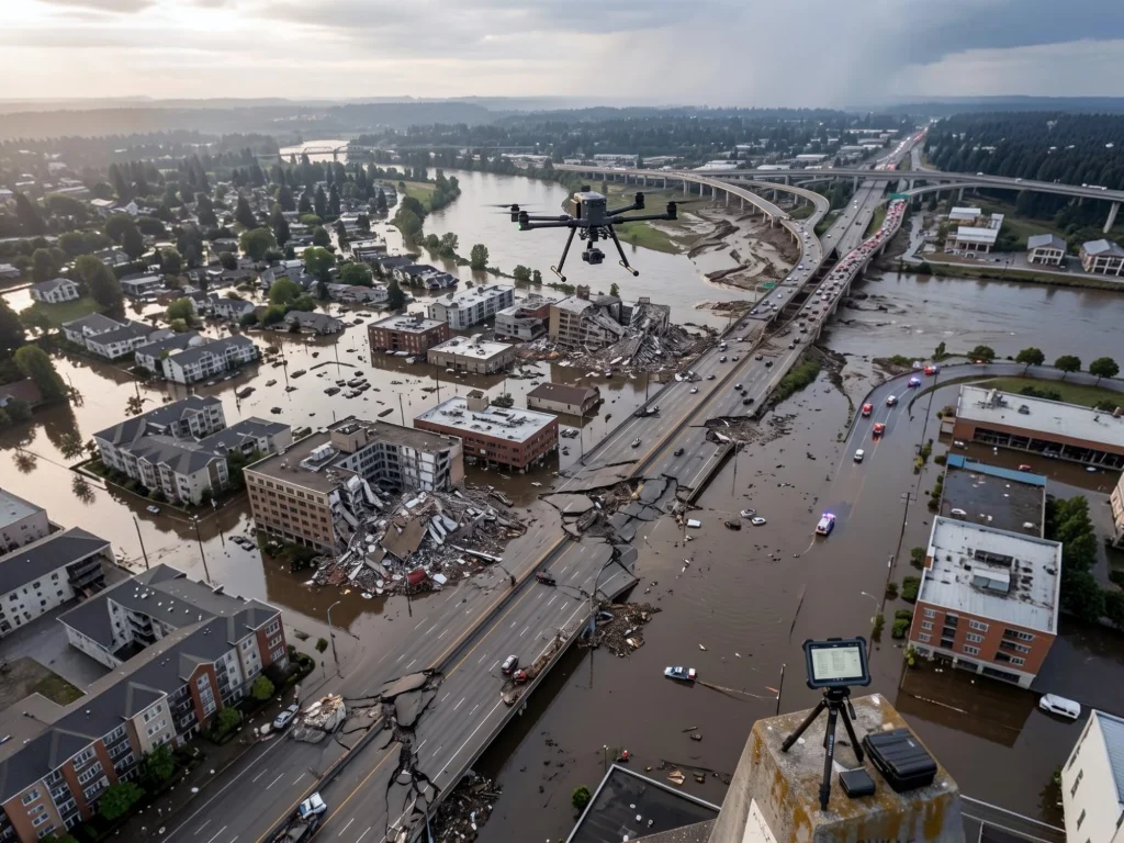
When a hurricane makes landfall or a major earthquake stops, the first question emergency managers ask isn’t how bad it is. It’s where. Where are the roads blocked, where have buildings collapsed, where are people cut off from help, and where should the first responders go. Getting that picture used to take days. Drone damage assessment is compressing that window to hours, and in some cases, to minutes.
This article looks at how UAVs are being used after natural disasters, what kind of data they actually produce, and why speed of information matters as much as speed of response in the critical hours after a disaster strikes.
The problem with the first 24 hours
Natural disasters don’t destroy infrastructure evenly. A flood doesn’t just fill roads with water, it washes out bridges, deposits debris across access routes, and leaves some neighborhoods completely unreachable by ground. An earthquake brings down structures in patterns that ground teams can’t map from street level without walking every block. A wildfire leaves some areas untouched and others completely cut off, and the boundary between the two shifts as conditions change.
Traditional damage assessment after a disaster relies on ground teams driving or walking affected areas, aerial surveys from manned aircraft, and satellite imagery. Each method has a bottleneck. Ground teams can only cover what they can physically reach, which in a major disaster is often exactly the problem. Manned aircraft are expensive, slow to mobilize, and produce imagery that still needs manual interpretation. Satellite imagery, while broad in coverage, is delayed by acquisition schedules, cloud cover, and processing time. In the hours immediately after impact, when decisions about resource allocation are most consequential, accurate spatial data is often exactly what’s missing.
What UAVs bring to disaster response
Drone damage assessment after natural disasters works because UAVs solve the specific bottlenecks that slow traditional methods down. A small team can deploy a drone within minutes of arriving at a staging area, fly over roads, bridges, and neighborhoods that are physically impassable, and return with high-resolution imagery before a ground team could cover the same distance on foot.
The data output isn’t just video footage. Modern disaster response drones equipped with photogrammetry payloads produce georeferenced orthomosaics, detailed aerial maps that show exactly which structures are damaged, which roads are passable, and where debris fields are concentrated. AI powered image analysis, like the CLARKE system developed at Texas A&M University and trained on drone imagery from more than 21,000 houses across ten major disasters including Hurricanes Harvey and Ian, can classify building damage automatically, turning hours of manual photo review into minutes of automated assessment. Emergency managers get a structured damage report, not a folder of images to scroll through.
Thermal imaging adds another layer. In search and rescue operations following earthquakes or building collapses, thermal sensors detect heat signatures from survivors in areas where visible light imagery shows only rubble. A drone can sweep a collapsed structure in minutes and flag locations where a thermal anomaly suggests a person is present, directing rescue teams to the highest priority points rather than having them work systematically through debris.
Three disaster types, three different workflows
The specific way drone damage assessment is deployed changes depending on what kind of disaster is being responded to.
After a flood, the primary need is road and bridge network assessment. Emergency managers need to know which routes are passable for supply convoys, which crossings are structurally compromised, and where water is still rising versus receding. Drones flying corridor surveys along road networks can map hundreds of kilometers in a single day, producing the passability data that logistics teams need to plan relief convoys. After Hurricanes Debby and Helene in 2024, agencies using the CLARKE drone assessment system documented road damages and building counts specifically to support both immediate response coordination and federal reimbursement documentation.
After an earthquake, the workflow shifts toward structural triage. Not every damaged building is equally dangerous, and not every collapsed structure has survivors. UAV structural assessment after seismic events focuses on identifying which areas have the highest concentration of collapsed or heavily damaged structures, so search and rescue teams can be directed to the highest probability locations first. The 2015 Nepal earthquake was one of the early large-scale examples of drones being used for this purpose, with UAVs assessing damage in remote areas that ground teams couldn’t reach for days.
After a wildfire, drone damage assessment serves a dual function. In the active phase, UAVs support situational awareness by mapping fire perimeters and identifying where structures are at immediate risk. In the recovery phase, the same platforms shift to damage documentation, mapping which structures burned, which survived, and what the access situation looks like for recovery teams moving into affected zones.
From imagery to decisions
The gap that drone damage assessment closes isn’t just about data collection. It’s about the speed at which that data becomes a decision. Raw drone footage that has to be manually reviewed by an analyst before it reaches an incident commander doesn’t solve the first-24-hours problem. It just shifts the bottleneck from collection to processing.
This is where AI integration in post-disaster UAV workflows has made the biggest practical difference. Automated damage classification, road passability scoring, and priority mapping take the output of a drone flight and translate it directly into the structured information that emergency managers need to allocate resources. Instead of “here is footage of the affected area,” the output becomes “here are 47 structures with confirmed major damage, here are 12 road segments that are blocked, and here are the three neighborhoods with no passable access route.” That level of structured output is what turns aerial imagery into operational decision support.
Regulatory and coordination realities
Deploying drones after a natural disaster isn’t as simple as flying to the scene and launching. Disaster zones frequently overlap with temporary flight restrictions, controlled airspace, and active manned aircraft operations running search and rescue and supply missions. Coordination between UAV operators and airspace managers is essential, and in the United States, programs like Florida UAS 1 exist specifically to coordinate drone operations across agencies during disaster response.
BVLOS capability, the ability to fly beyond visual line of sight, significantly expands what drone damage assessment can cover in a disaster scenario. Extended corridor surveys, large flood zones, and remote terrain all benefit from BVLOS operations. Regulatory frameworks are evolving to support this, with the FAA’s proposed Part 108 rules expected to make scaled BVLOS operations more accessible for exactly these kinds of applications.
Key takeaways
Drone damage assessment after natural disasters addresses a specific, critical gap: the absence of accurate spatial data in the hours immediately after impact, when decisions about resource allocation matter most. UAVs can reach areas that ground teams cannot, produce georeferenced data that satellite imagery cannot deliver in time, and feed AI powered classification systems that turn raw imagery into structured operational intelligence faster than any manual review process.
The technology doesn’t replace the emergency responders on the ground. It tells them where to go.