RTK vs PPK for Infrastructure Inspection: Which Positioning Method Fits Your Survey?
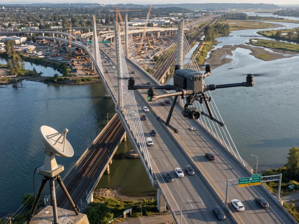
Centimeter-level accuracy sounds like a solved problem in drone surveying. Both RTK and PPK deliver it. Both use the same underlying principle, comparing a drone’s onboard GNSS data against a base station with a known position to correct satellite errors that would otherwise leave your data accurate only to within a few meters. On paper, the two methods look nearly identical. In practice, which one you choose shapes how your field operation runs, how reliable your data is across different environments, and whether you’re reprocessing flights or delivering clean results the first time.
This isn’t a question of which method is better in the abstract. It’s a question of which one fits the specific conditions of infrastructure inspection work.
How each method actually works
RTK, or Real-Time Kinematic, applies corrections during the flight itself. The base station on the ground sends raw GNSS data to the drone continuously over a radio or cellular link, and the drone’s onboard receiver uses that stream to compute its corrected position in real time. Every image is geotagged with a corrected coordinate the moment it’s captured. When it works cleanly, RTK delivers corrected data with no post-processing required, which means results are available almost immediately after landing.
PPK, or Post-Processed Kinematic, works differently. The base station and the drone both record raw GNSS data independently during the flight, with no active communication link between them. After the flight is complete, software matches the two datasets using image timestamps and applies the corrections, producing a geotagged dataset with the same centimeter-level accuracy as RTK, but only after processing.
Both methods reduce or eliminate the need for ground control points, which have traditionally been the main way to achieve survey-grade accuracy with drones. That reduction in GCP dependency is significant for infrastructure inspection, where placing and surveying physical ground markers across a bridge deck, a retaining wall, or a corridor running several kilometers adds substantial time and cost to every mission.
Where RTK works well and where it doesn’t
RTK’s advantage is speed. When the data link holds, corrected imagery is ready for processing the moment the drone lands. For active construction sites, stockpile volumetrics, or any project where a client or site manager needs results the same day, that immediacy has real value.
The limitation is the link itself. RTK requires four continuous communication lines to function correctly: satellites to drone, satellites to base station, base station to drone ground station, and drone ground station to drone. Any interruption in that chain breaks the correction stream. When the link drops, even briefly, the drone loses correction data for that portion of the flight, and re-initialization after a signal dropout can take long enough to create meaningful gaps in coverage. A field survey documented RTK-only flights losing up to 10 cm of accuracy when signal dropped mid-flight, while the same dataset corrected with PPK came back to under 3 cm.
For infrastructure inspection specifically, the environments where RTK struggles are common. Bridges often sit in valleys or river corridors with obstructed radio paths. Corridor inspections of roads, railways, or pipelines extend beyond the practical range of a local base station, typically capped at around 10 km. Dense urban environments introduce interference. Any of these conditions introduce exactly the kind of signal instability that degrades RTK performance.
Where PPK fits infrastructure work better
PPK removes the dependency on a live link entirely. The base station and drone work independently during flight, which means signal interruptions, obstructions, and extended range don’t affect the correction process. After the flight, the two datasets are matched in software and corrections are applied across the full trajectory, including any moments where RTK would have had gaps.
For large-area campaigns, corridor inspections, or surveys in remote or signal-challenged environments, PPK is consistently the more reliable choice. It also supports BVLOS operations more naturally, since the drone isn’t tethered to a live communication link with the base. Setup in the field is faster too: with PPK, the base station doesn’t need to be active and transmitting before the drone takes off, it just needs to be recording.
The tradeoff is processing time. PPK data isn’t ready immediately after landing. It requires post-flight software processing before the corrected dataset is available, which adds time to the workflow, typically hours rather than days, but enough to matter when a client is waiting on same-day deliverables.
The accuracy question
Both methods reach the same theoretical ceiling: centimeter-level absolute accuracy in the 1 to 3 cm range. The practical difference is consistency. RTK accuracy holds at roughly 2 to 5 cm when correction signals are strong and stable. PPK consistently delivers under 3 cm regardless of field conditions, because the correction is applied retrospectively with the complete dataset rather than on a signal-dependent real-time basis.
For infrastructure inspection, where the data feeds into structural assessments, maintenance planning, pavement condition reporting, or legal documentation, that consistency matters more than the raw number. A dataset that’s 2 cm accurate across 90% of a bridge survey and 10 cm accurate in the sections where the signal dropped is less useful than one that holds 3 cm accuracy throughout.
| Factor | RTK | PPK |
|---|---|---|
| Correction timing | Real time, during flight | Post-flight processing |
| Data link required | Yes, continuous | No |
| Results available | Immediately after landing | After post-processing |
| Accuracy (ideal conditions) | 2-5 cm | Under 3 cm |
| Accuracy (signal disruption) | Degrades, up to 10 cm gaps | Unaffected |
| Range from base station | Up to ~10 km | Flexible, no active link limit |
| BVLOS suitability | Limited by link range | Well suited |
| Best for | Time-sensitive, connected sites | Corridors, remote areas, large campaigns |
GCPs still have a role
Reducing GCP dependency is one of the main reasons infrastructure teams adopt RTK or PPK workflows in the first place. But eliminating them entirely isn’t always the right call. For projects requiring legal survey certification, or where absolute accuracy needs to be independently verified rather than trusted to GNSS correction alone, a small number of check points, not control points, serves a quality assurance function that neither RTK nor PPK can replace. The distinction matters: check points verify accuracy after the fact, while control points are used to correct it during processing. A well-run RTK or PPK workflow doesn’t need control points, but a few check points are still good practice on high-stakes infrastructure surveys.
Hybrid workflows
Some professional teams don’t choose between RTK and PPK at all. Receivers that log raw GNSS data while simultaneously receiving RTK corrections effectively run both methods in parallel. If the RTK link holds throughout the mission, the corrected data is ready immediately. If it doesn’t, the raw logged data is available for PPK post-processing as a fallback. For teams doing high-volume infrastructure inspection work across variable environments, this kind of hybrid setup removes most of the operational risk associated with committing to either method alone.
Which one actually fits your survey
The honest answer is that it depends on three things: how quickly results are needed, how reliable the signal environment is, and how far the mission extends from the base station.
If the site is a connected construction area, the client needs same-day data, and range isn’t a constraint, RTK is the right fit. If the inspection covers a bridge corridor, a remote retaining wall, an extended pipeline route, or any environment where signal reliability is uncertain, PPK is the more dependable choice. For teams doing both types of work regularly, a hybrid capable receiver makes the decision less binary and the operation more resilient across whatever conditions a given survey throws at it.