Types of Drone Cameras
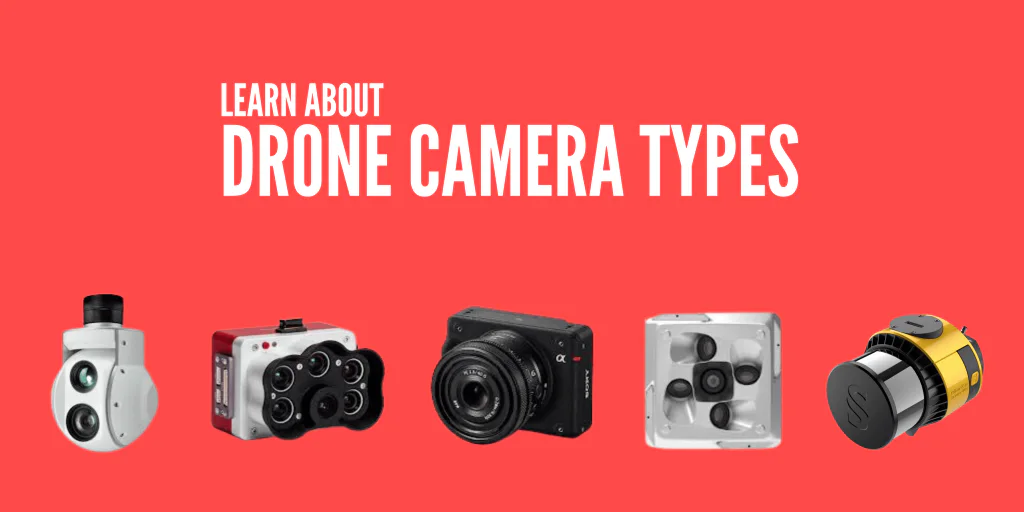
Drones have different cameras to capture various kinds of imagery. The cameras enhance their adaptability and versatility in diverse tasks and environments. So, what are the types of drone cameras?
The drone cameras include LiDAR, FLIR, RGB, multispectral, and more. Drones require different cameras for diverse applications such as heat signature detection, precision agriculture, photos and videos, and thermal imaging.
For instance, multispectral drone cameras suit agricultural tasks such as crop health monitoring and disease or stress detection.
Thermal drone cameras are ideal for heat signature detection in search and rescue missions.
Keep reading as we explore several drone cameras available on the market, their uses, and their limitations to help you improve your drone applications.
What Are the Different Types of Drone Cameras?
The various drone cameras include the following:
- LiDAR (Light Detection and Ranging)cameras
- FLIR (Forward-Looking Infrared) cameras
- RGB (Red, Green, and Blue) cameras
- Multispectral cameras
- Zoom cameras
- Oblique
Read on
LiDAR (Light Detection and Ranging) Cameras
The cameras use laser technology to measure ranges (variable distances) to the Earth.
Light detection and ranging is a remote sensing method of measuring distance by emitting light pulses (laser) and calculating the time it takes to bounce back from the object.
The LiDAR camera technology generates accurate 3D models of the surroundings by combining the light pulses with other recorded data. Three-dimensional information is beneficial for surveying and mapping.
A LiDAR device consists of a specialized GPS, a scanner, and a laser. Further, there is a topographic LiDAR and a bathymetric LiDAR. The former uses a near-infrared laser for land mapping; the latter uses water-penetrating green light to measure river elevations and the seafloor.
LiDAR Drone Cameras Uses:
- Providing precise elevation information for mining, construction, or urban planning projects for topographical mapping and surveying
- Generating detailed three-dimensional models of terrain and vegetation in forest management
- Assessing pipelines, power lines, and transportation networks during infrastructure inspections
LiDAR Drone Cameras Major Downsides:
- Its complexity requires a deep technological understanding, data processing skills, and the identification of inaccuracies or inconsistencies.
- Uncolored data makes it difficult to interpret without overlapping RGB photos.
- Limited resolution and range due to flight range and altitude restrictions
- Pulses’ inability to penetrate very dense vegetation
FLIR (Forward-Looking Infrared) Cameras
A FLIR is a thermal camera that uses infrared technology to create an infrared image of a scene without scanning it with a sensor.
The camera detects heat signatures, making it suitable for thermal imaging applications. It allows you to capture and visualize objects’ infrared radiation—not detectable with the naked eye—and convert it into visible images.
Thus, forward-looking infrared thermal cameras are most effective in low-visibility situations like darkness, smoke, or fog.
FLIR Drone Camera Uses:
- Detecting animals in their natural habitats during monitoring and conservation exercises without causing disturbance
- Identifying human heat signatures in challenging conditions during search and rescue missions
- Detecting gas leaks or identifying overheating components in electrical systems during industrial inspections
FLIR Drone Cameras Major Downsides:
- Arrays’ inconsistent pixel-to-pixel sensitivities
- Infrared rays’ inability to pass through water or glass
RGB (Red, Green, and Blue) Cameras
The RGB drone cameras use a color model that adds up the light’s primary colors (red, green, and blue) to form the different colors we perceive. They deliver colored images of the object by capturing light in red, green, and blue (RGB) wavelengths.
An RGB camera operates in visible light with a 400-700 nm wavelength range, a spectrum equivalent to the human eye’s. Its design aims to create images similar to human vision, capturing light in RGB wavelengths for precise color presentation.
Since an RGB camera uses light to produce color, it produces lighter images with more light illumination. It’s the most common drone camera for consumer drones.
RGB Drone Camera Uses:
- Real estate, social media, and marketing aerial photography and videography
- Structure inspection and surveying to assess damage and maintenance needs
- Capturing stunning aerial shots and providing unique perspectives for television and film production
Typically, RGB colors are ideal for devices that use light to produce images, such as digital cameras, computer monitors, and televisions.
RGB Drone Cameras Major Downsides:
- Ineffectiveness in low-light conditions.
Multispectral Cameras
A multispectral camera captures image data in various light spectrum bands beyond what the naked eye can see. It collects data across many visible and NIR (near-infrared) spectrum wavelengths in colors we can’t perceive.
Hence, multispectral cameras are valuable for soil and crop health analysis in the agricultural sector.
Multispectral Drone Cameras Uses:
- Boosting precision agriculture through crop health monitoring and pest and disease detection. Thus, you can optimize fertilization and irrigation strategies
- Enhancing environmental monitoring by tracking deforestation, monitoring coastal erosion, and analyzing water quality
- Revealing hidden features or artifacts beneath the surface during archaeological site exploration
Multispectral Drone Cameras Major Downsides:
- Inability to distinguish closely related materials due to spectral resolution limitations: 400-1000 nm spectral range and 4-5 typical brands.
Zoom Cameras
The cameras refer to a camera lens element system whose focal length varies (and so does the view angle). A zoom camera increases the object’s size without changing its position. That impacts the field of view (FOV), which decreases as you zoom in.
Drone Cameras Uses:
- ‘Zooming in’ specific objects or places for inspection and surveillance.
Oblique Cameras
Oblique cameras capture images at an angle rather than directly overhead, providing more detailed and three-dimensional views of the target area. These cameras are particularly useful for urban mapping, construction site monitoring, and disaster management. The 210MP Oblique Camera for DJI M200 and M300, for instance, offers high-resolution imagery through five sensors, each capturing different angles. This setup ensures comprehensive coverage and precise 3D modeling capabilities, making it ideal for applications requiring detailed and accurate representations of complex environments.
Oblique Drone Cameras Uses:
- Urban planning and infrastructure monitoring
- Creating detailed 3D models for construction and architectural applications
- Disaster management and assessment in complex terrains
Parting Shot
The various drone cameras have significantly revolutionized operations across diverse industries. They offer enhanced user experience by allowing users to gather valuable insights and data that would otherwise be difficult to capture.
Drone cameras have performed exceptionally well in everything from fantastic aerial photography and film footage to land mapping, surveillance, animal monitoring and conservation, and search and rescue missions.
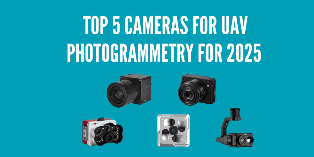
Check the top cameras for photogrammetry? Check here.
Want to learn what is the best software for photogrammetry? Check here.
What is the difference between photogrammetry and LiDAR surveying? Check here.