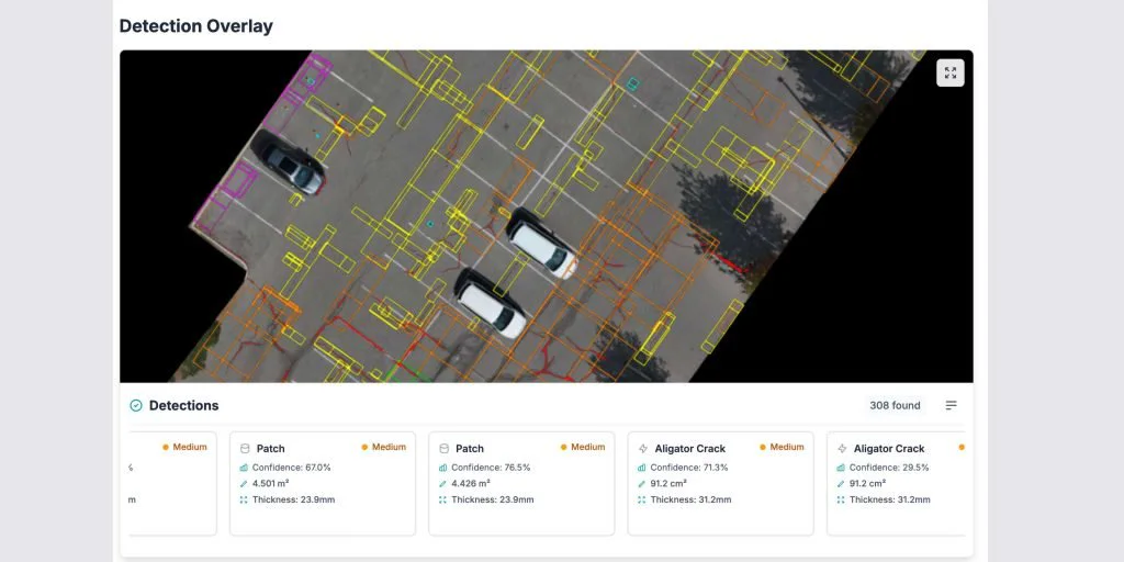
New in HALO AI: Full ASTM PCI, Deformation and Priced Repairs
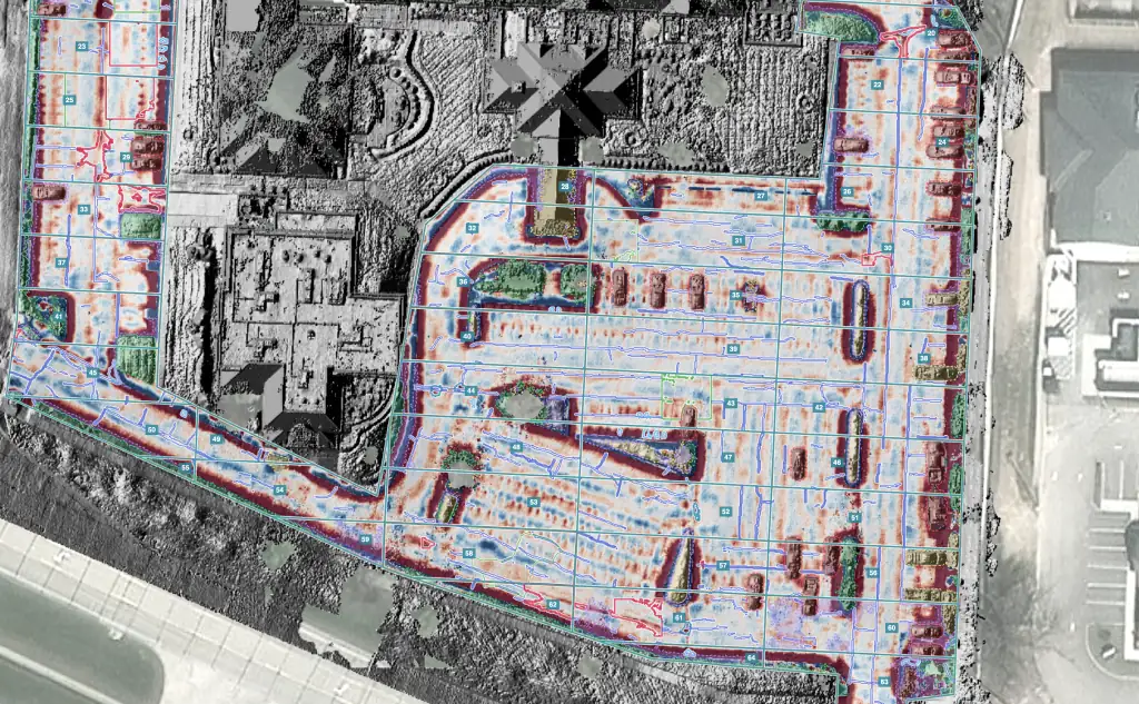
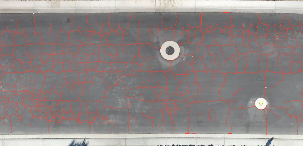
HALO AI, Fadron's drone pavement inspection software, turns one drone survey into a complete pavement condition report. It scores every distress in ASTM D6433 and ASTM D5340, measures the depth and height of the pavement surface, and returns a maintenance and repair plan priced at your own unit rates. Reports for roads and parking lots come back within 24 hours of upload.
If you know HALO AI for its crack tracing, this release is worth a second look before you choose a vendor for next season. The cracks are still traced and measured. Around them sits everything a pavement manager, an airport engineer or a paving contractor needs to budget the work, bid it and defend it.
Every ASTM distress, on asphalt, concrete and airfields
HALO AI computes the Pavement Condition Index from the full ASTM distress lists: cracking of every kind, potholes, patching, bleeding, raveling, and the deformation distresses described below. Roads and parking lots are scored to ASTM D6433, on asphalt and on jointed concrete. Runways, taxiways and aprons are scored to ASTM D5340.
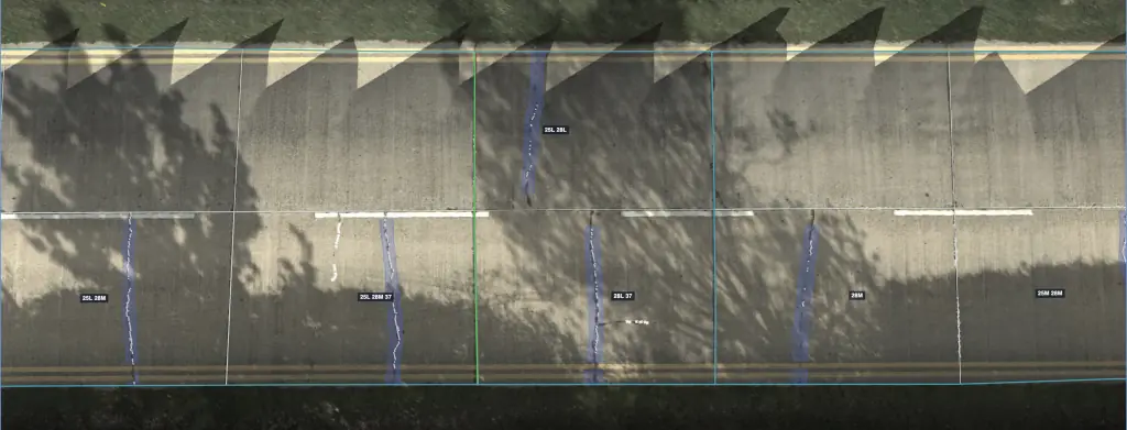
On jointed concrete the analysis works slab by slab. Every slab is outlined, and joint seal damage, joint spalling, divided slabs and shattered slabs are recorded against the slab they belong to. Each distress is identified by type and severity and measured in the units its repair is priced on: length, width, area, depth, height or volume. The survey covers 100% of the surface, where a manual inspection typically samples 10 to 20% of it.
Depth and height, measured from the drone photos
From the same drone photos that show the cracks, HALO AI measures the depth of ruts and depressions and the height of shoving, swells, bumps and sags, corrugation, edge drop-off, joint faulting, settled slabs and blowups. Every pothole on the plan comes with a measured depth, and standing water is reported by volume. ASTM sets the severity of these distresses by how deep or how high they are, so the measurement goes straight into the score.
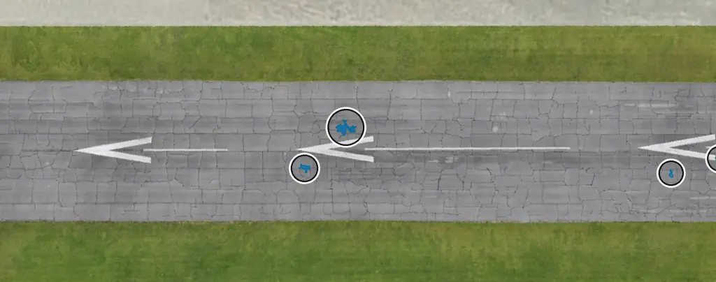
One anonymized road survey shows what this looks like in numbers. A 768 m² (about 8,270 sq ft) section scored PCI 13 out of 100, with ruts up to 42 mm (1.7 in) deep, depressions up to 62 mm (2.4 in), and 183 liters (48 gallons) of standing water. That survey is open to explore on the HALO AI page.
Accuracy you can compare against engineers
HALO AI traces and measures cracks with 98% accuracy, and its PCI score map agrees with qualified engineers' own scoring to 95%. That second figure matters because engineers scoring the same pavement typically differ from each other by about 16%. One model scores every HALO AI survey, so a change in the score from one year to the next is a change in the pavement.
Raw photos or an orthomosaic, graded before scoring
Send the raw photos from your survey drone, or an orthomosaic you have already processed. Every dataset receives a data-quality grade from A to D before it is scored. Vehicles, vegetation and curbs are excluded from the scored area, so a parked car or an overhanging tree never counts as pavement or as a defect.
A repair plan priced at your unit rates
Each survey becomes an engineering report built around a maintenance and repair plan. The plan totals the repair quantities and prices them at the unit rates you supply, so the budget in the report is built on your own prices. For a paving contractor, the same quantities are a bid takeoff measured across the whole site. The report also estimates the pavement's age and remaining life, and every new survey of the same site adds to its condition history.
One anonymized airfield report shows the planning view this gives an airport: 34,643 m² (about 373,000 sq ft) across 155 sample units, a PCI of 76, an estimated 14 years of remaining life, and 67% of the area still in preventive maintenance. That last figure is the one a budget committee should notice. Fadron's analysis puts proactive maintenance at about €12 per square meter, against about €130 per square meter once reconstruction is the only option.
Exports and a browser map
Results leave HALO AI as GeoPackage, shapefile, GeoJSON, KML, DXF for CAD, a quantities CSV, and a PAVER inspection file in XML or XLSX, in metric or imperial units. The report goes to the budget committee, the shapefile to GIS, the PAVER file into the pavement management system, and the CSV to whoever prices the work.
Anyone who was not on site can open the survey as an interactive map in a web browser. The Ortho view shows the drone imagery with every distress traced and scored, and the Relief and Shaded views show the shape of the surface.
Trip hazards and safety
On parking lots the same survey produces a trip-hazard and safety analysis: every hazard placed on a map and ranked by severity, with each dated survey kept as the record of the site's condition for insurers and for trip-and-fall and slip-and-fall claims. A typical lot takes about 15 minutes to fly, and the report is usually back the same day. The parking lot safety inspection guide covers it in depth.
See it on your own pavement
Request a demo to walk through a live survey with us, or get 1 ha analyzed free on your own site. The sample PCI report shows the full deliverable.